Loading
  • 21 Aug, 2019

  • By, Wikipedia

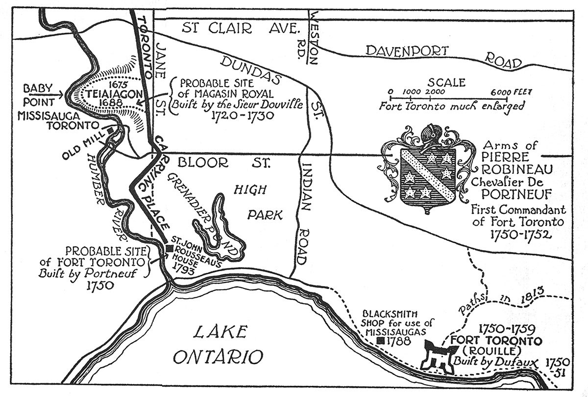
File:Charles W. Jefferys's Map Of Lower Humber Toronto.jpg

it was not subject to Crown copyright, and

2. it is a photograph that was created prior to January 1, 1949, or
3. the creator died prior to January 1, 1972.

You must also include a United States public domain tag to indicate why this work is in the public domain in the United States.

العربية  বাংলা  čeština  Deutsch  English  español  suomi  français  italiano  日本語  한국어  македонски  മലയാളം  Nederlands  português  português do Brasil  sicilianu  slovenščina  简体中文  繁體中文  +/−

Other versions

Captions

Add a one-line explanation of what this file represents

Items portrayed in this file

depicts

0.0125 second

4.28 millimetre

image/jpeg

94bc80afe69f10d9c746aa5164823cfb4a0a6abb

6,198,595 byte

3,456 pixel

4,608 pixel

File history

Click on a date/time to view the file as it appeared at that time.

Date/TimeThumbnailDimensionsUserComment
current19:27, 10 November 2019Thumbnail for version as of 19:27, 10 November 20194,608 × 3,456 (5.91 MB)Jon Kolbertbetter quality version
17:42, 6 November 2019Thumbnail for version as of 17:42, 6 November 2019600 × 456 (54 KB)Geo Swan{{Information |Description=Pierre Robineau's map of lower Humber Toronto. |Source=https://taiaiakon.wordpress.com/2012/09/19/taiaiaikon/ |Date=1750s |Author=Pierre Robineau |Permission={{PD-Canada}} |other_versions= }} Category:Pierre Robineau Category:Old maps of Toronto Waterfront Category:Humber Bay Category:Toronto Carrying Place Category:Humber River (Ontario)

Global file usage

The following other wikis use this file:

Metadata