This work is in the public domain in its country of origin and other countries and areas where the copyright term is the author's life plus 100 years or fewer.
You must also include a United States public domain tag to indicate why this work is in the public domain in the United States.
https://creativecommons.org/publicdomain/mark/1.0/PDMCreative Commons Public Domain Mark 1.0falsefalse
Captions
Add a one-line explanation of what this file represents
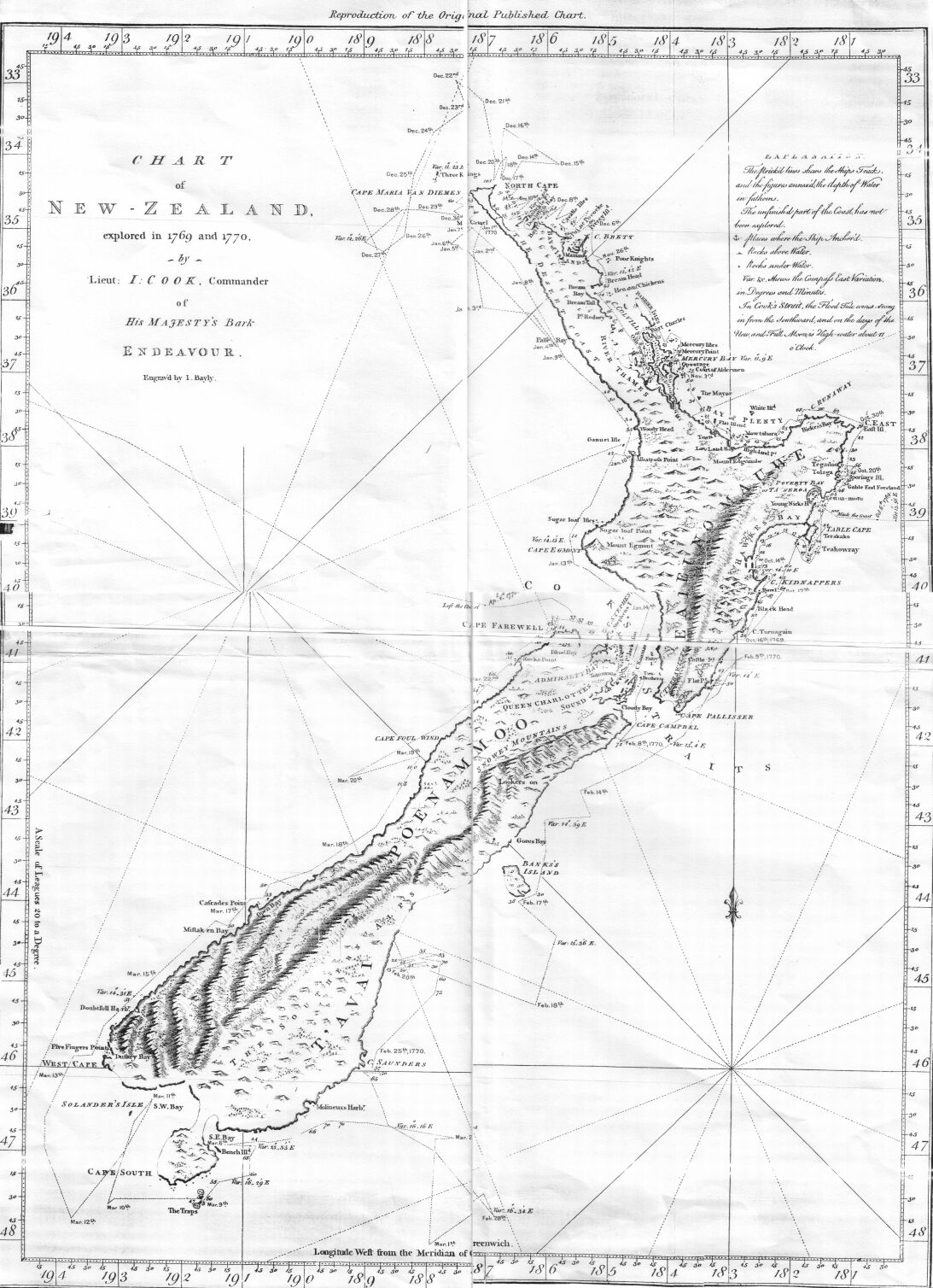
Grabado de John Bayly del mapa de Nueva Zelanda realizado por James Cook y su sobrino Isaac Smith, con el recorrido del HMB Endeavour alrededor de las dos grandes islas neozelandesas y publicado por John Hawkesworth en 1773.
== Summary == {{Information |Description=This is an image of a chart of New Zealand made by Lieutenant (later Captain Sir) James Cook during his 1770 voyage of exploration in the Pacific in command of HM Bark ''Endeavour''. |Source=Taken from the
 You must also include a United States public domain tag to indicate why this work is in the public domain in the United States.