Click on a date/time to view the file as it appeared at that time.
| Date/Time | Thumbnail | Dimensions | User | Comment |
|---|
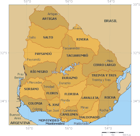
| current | 09:47, 18 September 2005 | 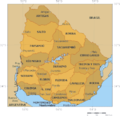 | 450 × 436 (26 KB) | Tvpm | |
| 16:23, 4 April 2005 |  | 450 × 436 (106 KB) | David Legrand | * '''Description''' : Political map of Uruguay * '''Author''' : [http://enciclopedia.us.es/index.php/Imagen:Mapa_pol%EDtico_de_Uruguay.png Enciclopedia Libre]<br /> Original map generate with the aplication [http://www.aquarius.geomar.de/omc_intro.html On |
The following 2 pages use this file:
The following other wikis use this file:
- Usage on af.wikipedia.org
- Usage on an.wikipedia.org
- Usage on ast.wikipedia.org
- Usage on azb.wikipedia.org
- Usage on bar.wikipedia.org
- Usage on br.wikipedia.org
- Usage on bs.wikipedia.org
- Usage on ca.wikipedia.org
- Usage on ceb.wikipedia.org
- Usage on cs.wikipedia.org
- Usage on de.wikipedia.org
- Usage on eo.wikipedia.org
- Usage on es.wikipedia.org
- Usage on es.wikinews.org
- Usage on fa.wikipedia.org
- Usage on fr.wikipedia.org
- Usage on gl.wikipedia.org
- Usage on he.wikipedia.org
- Usage on hif.wikipedia.org
- Usage on hi.wikipedia.org
- Usage on hr.wikipedia.org
- Usage on hu.wikipedia.org
- Usage on hy.wikipedia.org
- Usage on it.wikipedia.org
- Usage on ja.wikipedia.org
- Usage on ka.wikipedia.org
- Usage on la.wikipedia.org
View more global usage of this file.


.png)
.png)
.png)