Click on a date/time to view the file as it appeared at that time.
| Date/Time | Thumbnail | Dimensions | User | Comment |
|---|
| current | 14:26, 30 January 2010 | 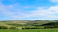 | 640 × 356 (108 KB) | GeographBot | == {{int:filedesc}} == {{Information |description={{en|1=Downland above Brighton. Taken from the bottom left hand corner where the bridleway briefly enters the square this view looks east along an unnamed section of the downs. The trees in the middle mark |
The following page uses this file:
This file contains additional information, probably added from the digital camera or scanner used to create or digitize it.
If the file has been modified from its original state, some details may not fully reflect the modified file.
