File:Map Of Trans-African Highways.PNG
This road has been surfaced since at least 2007.
Click on a date/time to view the file as it appeared at that time.
| Date/Time | Thumbnail | Dimensions | User | Comment | |
|---|---|---|---|---|---|
| current | 11:28, 19 June 2023 | 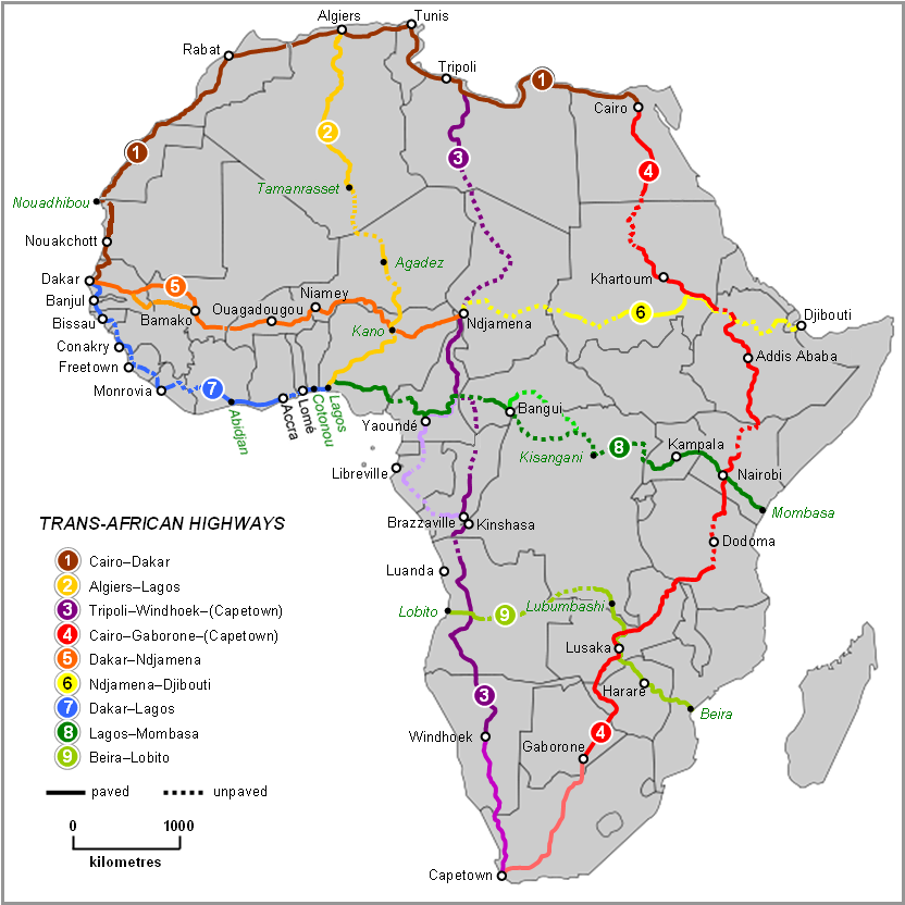 | 832 × 832 (211 KB) | Abdelrhman 1990 | Map correction |
| 05:56, 6 February 2022 |  | 832 × 832 (155 KB) | SounderBruce | Reverted to version as of 20:18, 8 November 2020 (UTC): Improper upscaling | |
| 00:45, 19 January 2022 |  | 1,922 × 1,918 (1,016 KB) | Arrecife | 2022 update per Michelin Afrique & Google Earth | |
| 16:24, 14 January 2022 |  | 615 × 614 (185 KB) | Arrecife | Reverted to version as of 05:53, 6 December 2019 (UTC) smaller size, but up to date | |
| 20:18, 8 November 2020 |  | 832 × 832 (155 KB) | Leviavery | Reverted to version as of 09:25, 23 August 2019 (UTC) Much higher quality image | |
| 05:53, 6 December 2019 |  | 615 × 614 (185 KB) | Arrecife | Updating of all roads, from Michelin Africa plus Google Earth | |
| 09:25, 23 August 2019 |  | 832 × 832 (155 KB) | NordNordWest | adding South Sudan | |
| 00:02, 9 October 2014 |  | 832 × 832 (202 KB) | Bobrayner | Slight corrections/updates to map, ie. Nouakchott-Nouadhibou road was completely surfaced a few years ago Morocco-Algeria border is closed; &c. | |
| 07:12, 18 July 2007 |  | 832 × 832 (175 KB) | Rexparry sydney~commonswiki | {{Information |Description=Map of Trans-African Highways based on data 2000 to 2003 |Source=Word doc drawing based in Wikipedia blank Africa map |Date=17 July 2007 |Author=Rex Parry |Permission=Yes |other_versions= }} |
The following 13 pages use this file:
The following other wikis use this file:
View more global usage of this file.