File:Rheinbund 1806, Political Map.png
Click on a date/time to view the file as it appeared at that time.
| Date/Time | Thumbnail | Dimensions | User | Comment | |
|---|---|---|---|---|---|
| current | 14:51, 4 September 2024 | 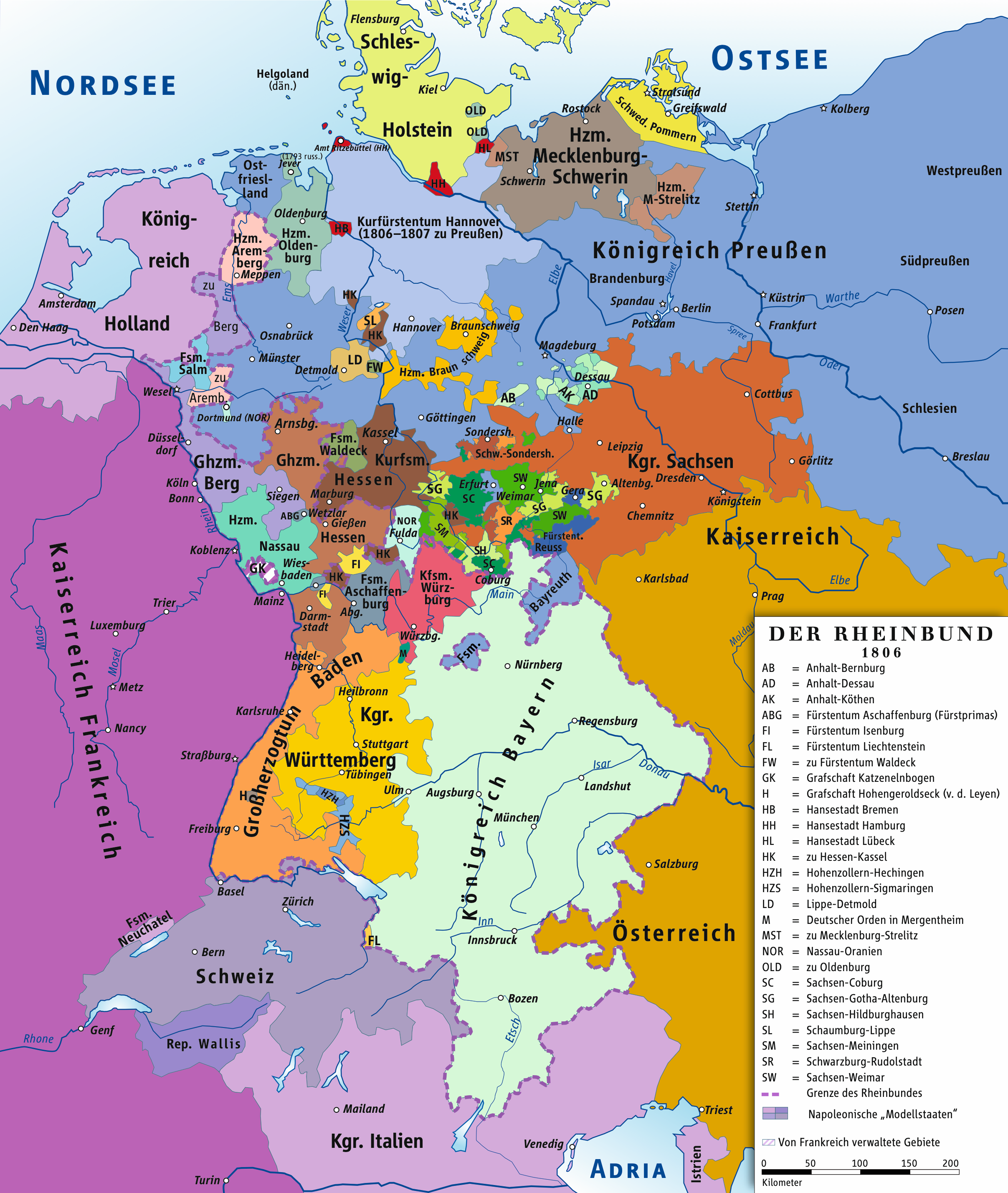 | 1,207 × 1,427 (804 KB) | Ziegelbrenner | 2024-09-04 |
| 13:57, 24 October 2022 |  | 2,414 × 2,855 (1.93 MB) | Ziegelbrenner | Städte wieder eingefügt | |
| 13:36, 10 April 2019 |  | 2,414 × 2,854 (1.38 MB) | Ziegelbrenner | Ghzm. Würzburg | |
| 14:19, 1 August 2018 |  | 1,998 × 2,362 (13.51 MB) | Ziegelbrenner | Hessen-Kaselschen Anteil an Schaumburg nachgetragen | |
| 12:58, 31 July 2018 |  | 1,772 × 2,095 (10.63 MB) | Ziegelbrenner | Corrected Hannover + Amt Ritzebüttel | |
| 11:50, 14 February 2014 |  | 1,998 × 2,362 (1.13 MB) | Ziegelbrenner | 2014-02-14 | |
| 10:25, 3 February 2014 |  | 1,998 × 2,362 (1.97 MB) | Ziegelbrenner | 2014-02-03 | |
| 10:22, 3 February 2014 |  | 2,008 × 2,362 (1.85 MB) | Ziegelbrenner | Reverted to version as of 16:14, 30 January 2014 | |
| 13:28, 31 January 2014 |  | 507 × 599 (187 KB) | Ziegelbrenner | Reverted to version as of 16:03, 20 January 2014 Why did you revert this? New version has some corrections. | |
| 16:14, 30 January 2014 |  | 2,008 × 2,362 (1.85 MB) | Эрманарих | Reverted to version as of 14:53, 3 February 2011 |
File usage
The following 8 pages use this file:
Global file usage
The following other wikis use this file:
- Usage on azb.wikipedia.org
- Usage on be.wikipedia.org
- Usage on ca.wikipedia.org
- Usage on cv.wikipedia.org
- Usage on de.wikipedia.org
- 1806
- Maximilian I. Joseph (Bayern)
- Friedrich Wilhelm III. (Preußen)
- Rheinbund
- Königreich Bayern
- Geschichte der Stadt Düsseldorf
- Rheinkrise
- Residenzstadt
- Vertrag von Schönbrunn
- Benutzer:TravenTorsvan/Baustelle/Babel
- Benutzer:Ziegelbrenner/Meine Bilder auf Commons
- Liste der Mitgliedstaaten im Rheinbund
- Wikipedia:Auskunft/Archiv/2014/Woche 47
- Vertrag von Paris (15. Februar 1806)
- Wikipedia:WikiProjekt Kategorien/Diskussionen/2023/August/12
- Wikipedia:Löschkandidaten/12. August 2023
- Usage on el.wikipedia.org
- Usage on eo.wikipedia.org
- Usage on es.wikipedia.org
- Usage on et.wikipedia.org
- Usage on fi.wikipedia.org
- Usage on fr.wikipedia.org
- Usage on he.wikipedia.org
- Usage on id.wikipedia.org
- Usage on it.wikipedia.org
- Usage on ja.wikipedia.org
- Usage on ko.wikipedia.org
- Usage on krc.wikipedia.org
- Usage on lv.wikipedia.org
- Usage on ms.wikipedia.org
- Usage on nl.wikipedia.org
- Usage on ru.wikipedia.org
- Usage on sh.wikipedia.org
- Usage on sl.wikipedia.org
View more global usage of this file.