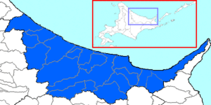
Abashiri Subprefecture
Okhotsk Subprefecture (オホーツク総合振興局, Ohōtsuku-sōgō-shinkō-kyoku) is a subprefecture of Hokkaido Prefecture, Japan. It was renamed from the earlier Abashiri Subprefecture on April 1, 2010. Abashiri Subprefecture was established in 1897.

Okhotsk Subprefecture
Etymology
Abashiri Prefecture was named after the subprefectural office in Abashiri. However, the area was more commonly referred to as the Okhotsk region (オホーツク地方, Ohōtsuku-chihō), as it faces the Sea of Okhotsk, and the name Abashiri was changed to the more commonly used Okhotsk during the administrative redivision of Hokkaido's 14 subprefectures to 9 subprefectural bureaus in April, 2010. The sea is named for the port of Okhotsk, itself named for the Okhota, whose name is derived from the Even word окат (okat) meaning "river".
Geography

Municipalities
| Name | Area (km) | Population | District | Type | Map | |
|---|---|---|---|---|---|---|
| Rōmaji | Kanji | |||||
| 網走市 | 470.94 | 34,919 | no district | City | 
| |
| 美幌町 | 438.36 | 20,920 | Abashiri District | Town | 
| |
| 遠軽町 | 1,332.32 | 20,757 | Monbetsu District | Town | 
| |
| 北見市 | 1,427.56 | 119,135 | no district | City | 
| |
| 清里町 | 402.73 | 4,222 | Shari District | Town | 
| |
| 小清水町 | 287.04 | 5,029 | Shari District | Town | 
| |
| 訓子府町 | 190.89 | 5,227 | Tokoro District | Town | 
| |
| 紋別市 | 830.7 | 22,983 | no district | City | 
| |
| 西興部村 | 308.12 | 1,120 | Monbetsu District | Village | 
| |
| 置戸町 | 527.54 | 3,042 | Tokoro District | Town | 
| |
| 興部町 | 362.41 | 3,963 | Monbetsu District | Town | 
| |
| 雄武町 | 637.03 | 4,596 | Monbetsu District | Town | 
| |
| 大空町 | 343.62 | 7,430 | Abashiri District | Town | 
| |
| 佐呂間町 | 404.99 | 5,617 | Tokoro District | Town | 
| |
| 斜里町 | 736.97 | 11,897 | Shari District | Town | 
| |
| 滝上町 | 786.89 | 2,757 | Monbetsu District | Town | 
| |
| 津別町 | 716.6 | 5,011 | Abashiri District | Town | 
| |
| 湧別町 | 505.74 | 8,474 | Monbetsu District | Town | 
| |
Mergers
References
- ^ Everett-Heath, John (2020). "Okhotsk, Sea of (Okhotskoye More)". Concise Oxford Dictionary of World Place Names (6th ed.). Oxford University Press. ISBN 9780191905636.
- ^ "Охота". Вода России (in Russian). Retrieved 2020-06-15.
External links
- Official website (in Japanese)