Aguanish, Quebec
Aguanish is a municipality located on the banks of the Aguanish River, on the north shore of Jacques Cartier Strait, in the Gulf of St. Lawrence, in Minganie Regional County Municipality, Côte-Nord region, Quebec, Canada.
In addition to Aguanish itself, the municipality also includes the hamlet of L'Île-Michon, 3.5 kilometres (2.2 mi) to the East.
Community
Aguanish has barely 300 inhabitants, the Aguanishoises and Aguanishois live in one of the smallest municipalities in Quebec.
- Aguanish in the morning mist
-
 Fishing boats at the dock
 -
![Traps for crab fishing[10]](//upload.wikimedia.org/wikipedia/commons/thumb/a/a0/Aguanish_19.jpg/240px-Aguanish_19.jpg) Traps for crab fishing
Traps for crab fishing -

-
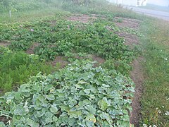 Vegetable garden: carrots, radishes, potatoes

![Traps for crab fishing[10]](/key/File:Aguanish_19.jpg)


L'Île Michon
The hamlet of L'Île Michon is located opposite the island of the same name, 700 m from the coast and 3.5 km downstream from Aguanish, on the coast of the Jacques Cartier Strait, in the Gulf of St. Lawrence.
According to certains sources, Île-Michon was founded by Jean Michon, a craftsman who landed on the island opposite the village to build fishing boats.
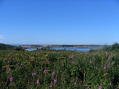
- L'Île Michon (Hamlet), Jacques Cartier Strait, Gulf of St. Lawrence
-
 Coastline, rocky base and beach
 -
 Islands, islets, rocks, cays and reefs
 -
 Vieux Quai Street


Toponymy
Aguanish is named after the Goynish or Aguanish River (ancien name Aguanus River), that flows through and drains into the Strait of Jacques Cartier, in the Gulf of St. Lawrence right at the village. This word of Innu origin came from aguanus, in turn from akwanich, from the roots akwan (shelter) and ich (small). It has undergone many different spellings, including: Goines (17th century); Guanis, Goinis (1744 map by Bellin); Goynish (1776 map by Carver); Agwanus, Aguanus or Agouanus (maps of the 19th century).
History
The main prehistoric cultures, called "archaic", were based on three sets of groups coming from the southwest, from as far away as the Great Lakes via the St. Lawrence River, those coming from the great plateaus of the interior and James Bay, and those from Newfoundland, Nova Scotia and New England.
From the 14th to the 17th century, the presence of Europeans in the regions of the North Shore and the Gulf of St. Lawrence began with the periodic visits of the Basques and Breton fishermen.
In 1831, the Hudson's Bay Company opened the Nabisipi trading post (also spelled Nabaysepie, Nabaysippi, or Nabaysipieat) at the mouth of the Nabisipi River (just west of the current town site). After a brief closure, it was reopened in 1832, and operated until circa 1860.
The first European inhabitants, fishermen from the Magdalen Islands, settled in the area circa 1849. They were joined in 1875 by people from Kégashka (today Kegaska) and from Nabisipi River. Until the advent of World War II (1939-1945) the growth of the population occurred in concert with the development of the pulp and paper industry.
The place was incorporated as a municipality in 1957.
Demographics
Population
| 2021 | 2016 | 2011 | |
|---|---|---|---|
| Population | 224 (-8.6% from 2016) | 245 (-11.9% from 2011) | 278 (-8.3% from 2006) |
| Land area | 532.04 km (205.42 sq mi) | 586.40 km (226.41 sq mi) | 600.61 km (231.90 sq mi) |
| Population density | 0.4/km (1.0/sq mi) | 0.4/km (1.0/sq mi) | 0.5/km (1.3/sq mi) |
| Median age | 59.6 (M: 59.6, F: 59.6) | 54.1 (M: 56.0, F: 52.8) | 49.7 (M: 51.4, F: 48.3) |
| Private dwellings | 152 (total) 119 (occupied) | 148 (total) | 145 (total) |
| Median household income | $N/A | $55,936 | $N/A |
References: 2021 2016 2011
|
| |||||||||||||||||||||||||||||||||||||||||||||
| Source: Statistics Canada | ||||||||||||||||||||||||||||||||||||||||||||||
Language
| Canada Census Mother Tongue - Aguanish, Quebec | ||||||||||||||||||
|---|---|---|---|---|---|---|---|---|---|---|---|---|---|---|---|---|---|---|
| Census | Total | French
|
English
|
French & English
|
Other
| |||||||||||||
| Year | Responses | Count | Trend | Pop % | Count | Trend | Pop % | Count | Trend | Pop % | Count | Trend | Pop % | |||||
2016
|
245
|
240 | 98.0% | 0 | 0.0% | 0 | 0.0% | 5 | 2.0% | |||||||||
2011
|
280
|
275 | 98.2% | 5 | 1.8% | 0 | 0.0% | 0 | 0.0% | |||||||||
2006
|
300
|
290 | 96.7% | 0 | 0.0% | 0 | 0.0% | 10 | 3.3% | |||||||||
2001
|
335
|
335 | 100.0% | 0 | 0.0% | 0 | 0.0% | 0 | 0.0% | |||||||||
1996
|
375
|
375 | n/a | 100.0% | 0 | n/a | 0.0% | 0 | n/a | 0.0% | 0 | n/a | 0.0% | |||||
Economy
Economic activity primarily centers on crab and salmon fishing.
Transportation
By Route 138, according to Google Map, Aguanish is 125 kilometres (78 mi) from Havre-Saint-Pierre and 341 kilometres (212 mi) from Sept-Îles.
Until the arrival of The Whale Route (Route 138) in 1996, a regular means of access to the area was the boat service maintained during the navigation season by Clarke Steamship Company, Ltd, sailing from Montreal and Quebec. Also, numerous lakes of the area provide suitable landings for floatplane based at Mingan and Havre-Saint-Pierre. Canoe travel is difficult in the region and require several portages.
See also
References
- ^ "Aguanish River - Toponymy". Gouvernement of Quebec (in French). Commission de Toponymy Quebec. 11 April 1985. Retrieved 3 September 2024.
One of the remarkable elements of its route is the Trait de Scie, a narrow and deep canyon into which the river rushes less than 6.5 km from its mouth.
- ^ "Aguanish". Quebec Gouvernement. Commission de Toponymie Quebec. 1968-12-05. Retrieved 16 May 2024.
The village is located 20 km west of Natashquan and 56 km from Baie-Johan-Beetz
- ^ "Répertoire des municipalités: Geographic code 98030". www.mamh.gouv.qc.ca (in French). Ministère des Affaires municipales et de l'Habitation.
- ^ "Aguanish, Municipalité (MÉ) Census Profile, 2021 Census of Population". www12.statcan.gc.ca. Government of Canada - Statistics Canada. Retrieved 17 May 2022.
- ^ National Research Council Canada - Time Zones & Daylight Saving Time Archived 2010-03-17 at the Wayback Machine
- ^ "The Explorers Jacques Cartier 1534-1542". Canadian Museum of History. Retrieved 6 September 2024.
Jacques Cartier was a sufficiently experienced navigator to be asked by Francis I to undertake the official exploration of North America. There is no doubt that he was already familiar with the sea route that he took in 1534
- ^ "L'Île-Michon, hamlet". Quebec Gouvernement (in French). Commission de Toponymie Quebec. 1986-12-18. Retrieved 17 May 2024.
The hamlet is named L'Île-Michon in memory of Captain Jean-Phidyme Michon who was shipwrecked in November 1876
- ^ "Aguanish and Île-Michon sector" (PDF) (in English and French). Côte-Nord Tourism. 25 January 2023. p. 2. Retrieved 9 September 2024.
Touristicical attractions and activities - Map
- ^ "Aguanish: an invitation to take the time" (in French). Municipality of Aguanish. 2024. Retrieved 10 September 2024.
Aguanish covers an enormous territory of almost 600 square kilometers.
- ^ "Municipality of Aguanish de la Côte-Nord". Grand Quebec. 2024. Retrieved 16 May 2024.
A crab fishing ground to meet the needs of its residents and salmon, out of passion.
- ^ "Michon Island, toponymy". Gouvernement of Quebec (in French). Commission de Toponymy Quebec. 25 February 1976. Retrieved 7 September 2024.
According to some, the island takes its name from Jean Michon, a craftsman who settled on the island in 1850 to build boats.
- ^ "Aguanish history". Official site (in French). Municipality of Aguanish. Retrieved 17 May 2024.
The municipality covers an enormous territory of nearly 600 square kilometers.
- ^ Pierre Frenette (2013). "The Gulf Historical Society" (in French). Retrieved 10 July 2024.
a legacy left by the meeting of several worlds, including that of the Laurentian peoples, that of the indigenous peoples of the interior and those of the different maritime peoples of the Gulf of St. Laurent
- ^ "The prehistory of Quebec". Archeo-Quebec (in French). The archeology dissemination network. 2024. Retrieved 10 July 2024.
Archaic Native Americans exploited all available animal and plant resources. They live a seasonal nomadism
- ^ "Hudson's Bay Company: Nabisipi". pam.minisisinc.com. Archives of Manitoba - Keystone Archives Descriptive Database. Retrieved 30 October 2023.
- ^ "2021 Community Profiles". 2021 Canadian census. Statistics Canada. February 4, 2022. Retrieved 2023-10-19.
- ^ "2016 Community Profiles". 2016 Canadian census. Statistics Canada. August 12, 2021. Retrieved 2022-02-25.
- ^ "2011 Community Profiles". 2011 Canadian census. Statistics Canada. March 21, 2019. Retrieved 2014-02-16.
- ^ 1996, 2001, 2006, 2011 census
- ^ "Network of observation sites along the Whale Route (Route 138)" (PDF). 2010-05-21. p. 12. Retrieved 11 May 2024.
Whale-watching sites for everyone
- ^ "Whales of the St. Lawrence river". Whales Online. 2024. Retrieved 18 April 2024.
The estuary is home to belugas all year round. In summer, the estuary also hosts rorquals and other species of toothed whales that benefit from the abundance of krill, capelin and other small fish.
- ^ "The Clarke Steamship Co Ltd" (PDF). 7 June 2014. pp. 41 of 74. Retrieved 17 May 2024.
The North Shore service now sailed from Quebec every Tuesday at 9 am, serving no fewer than thirty locales, consisting of pulpwood ports, native villages, trading posts and fishing settlements,
- ^ Duncan S. McPhee (1959). "Preliminary report on the Aguanish region, Saguenay Electoral District" (PDF). Ministry of Energy and Natural Resources - Government of Quebec. p. 8.
The Aguanish area was mapped during the summer 1958 - Travel by canoe is difficult within the area and requires considerable portaging.
External links
- Duhaime Gérard (dir.), 2001, Historical Atlas of Quebec. The North, inhabitants and changes. Quebec, University Press, Laval - 227 p. (French)
- Official website
 , Welcome to Aguanish
 - Father Victor Lachance, Aguanish, a little history..., important dates, Association des Familles Laroche et Rochette Inc. (French)
- Royal Canadian Geographical Society, Maze to the Aguanish, a 680 kilometre canoe trip through the wilds of Labrador and Quebec, 2021
Adjacent Municipal Subdivisions | |
|---|---|
| Administrative units |
| ||||
|---|---|---|---|---|---|
| Protected areas | |||||
| Major river basins | |||||
| Significant lakes | |||||
| Transport infrastructure | |||||
| |||||