Baie-Trinité
In addition to Baie-Trinité itself, the village municipality also includes the hamlet of Pointe-des-Monts, site of Pointe-des-Monts Lighthouse.
Pointe-des-Monts Lighthouse
The Pointe-des-Monts Lighthouse, a National historic site of Canada, was built in 1829–1830 on a point that ancient geographers, since Samuel de Champlain (1567-1655) himself, classified as the demarcation point between the St. Lawrence River and the Gulf of St. Lawrence.
In 2023, all the facilities of the Pointe-des-Monts lighthouse include the lighthouse, the keeper's house and the footbridge. Over time, since its installation in 1830, several buildings have been demolished, as example, given the impressive number of shipwrecks at this time, a provision depot for shipwreck victims was built in 1831.
- Pointe-des-Monts Lighthouse
-
Information panel
-
Information panel
-
Keeper's house and outbuildings
-
The keeper's house, the outbuildings, parking lot
-
Interested visitor, stairs and artifacts
Toponymy

The village municipality are named after the small Trinity Bay into which the Trinity River drains. The river's name may be attributed to Jacques Cartier who sailed by this river on Trinity Sunday in 1536. The first permanent settlers came in 1840, the Baie-de-la-Trinité Mission was established in 1898.
Geography
The municipality is located on the north shore of the Gulf of St. Lawrence at the mouth of the Trinity River (French: Rivière de la Trinité), a salmon river which flows through the village.
The main access to the municipality is Route 138, also known as the Whale Route. The major economic sectors are forestry and fisheries.
- Gulf of St Lawrence
-
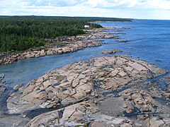
From the top of the lighthouse Pointe des Monts bedrock, gulf side
-
From the top of the lighthouse, Pointe des Monts bedrock, estuary side
Ludger-Champagne rest area
The rest area belongs to the Ministère des Transports du Québec, it is located in Baie-Trinité, on the Route des Baleines, (Route 138), between Labrie and Jourdain streets, it recalls the memory of Ludger Champagne (1929-2020).
Mr. Champagne founded the Club 4 H of Baie-Trinité in 1966 and was an important player in the construction of the building that housed the 4-H relay, a rest area for the local population and travellers. The 4-H Clubs of Quebec, which brought together young people aged 8 to 18, were committed to the protection and conservation of the environment. The 4-H movement was created in 1912 in the United States and established in Quebec in 1942 by the Quebec Forestry Association.
- Rest area Ludger-Champagne
-
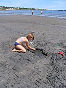
Beach, gulf of St Lawrence
-
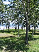
Route 138, picnic area, beach, gulf of St Lawrence
-
Beach, gulf of St Lawrence
-
Route 138, beach, gulf of St Lawrence
Demography
In the 2021 Census of Population conducted by Statistics Canada, Baie-Trinité had a population of 438 living in 231 of its 341 total private dwellings, a change of 7.6% from its 2016 population of 407. With a land area of 417.48 km (161.19 sq mi), it had a population density of 1.0/km (2.7/sq mi) in 2021.
|
| ||||||||||||||||||||||||||||||||||||||||||||||||
| Population counts are not adjusted for boundary changes. Source: Statistics Canada | |||||||||||||||||||||||||||||||||||||||||||||||||
Mother tongue (2021):
- English as first language: 1.1%
- French as first language: 94.3%
- English and French as first language: 0%
- Other as first language: 3.4%
References
- ^ "Pointe-des-Monts Lighthouse". Gouvernement of Quebec (in French). Commission de Toponymy Quebec. 7 May 2003. Retrieved 18 September 2024.
This lighthouse is located in Baie-Trinité, in the hamlet of Pointe-des-Monts; it was classified as a monument and historic site on September 8, 1965.
- ^ "Pointe des Monts". Commission de toponymie Quebec (in French). Government of Quebec. 1968-12-05. Retrieved 25 February 2024.
From the shoreline of Pointe des Monts to the city of Matane, opposite, in the Gaspé Peninsula, the distance is only 52 km. These points serve as a boundary between the estuary of the St. Lawrence River upstream and the much wider Gulf of St. Lawrence downstream
- ^ "Répertoire des municipalités: Geographic code 96005". www.mamh.gouv.qc.ca (in French). Ministère des Affaires municipales et de l'Habitation.
- ^ "Baie-Trinité (Code 2496005) Census Profile". 2021 census. Government of Canada - Statistics Canada. Retrieved 2024-06-18.
- ^ "The Pointe-des-Monts Lighthouse" (in French). Corporation de Promotion et de Développement du site du Phare historique de Pointe‑des‑Monts. 2024. Retrieved 25 February 2024.
Built on a rocky outcrop that forms an islet at high tide, the lighthouse bears witness to a time when navigation in the Gulf of St. Lawrence was perilous.
- ^ Edward F. Bush (1975). "The Canadian Lighthouse" (PDF). National Historic Parks and Sites, Branch, Indian and Northern Affairs. pp. 55 of 188. Retrieved 25 February 2024.
The first lighthouse, completed in 1830, had walls six feet thick at the base, tapering to two feet at the lantern deck.20
- ^ "Characterization of buildings and sectors with heritage potential in the MRC of Manicouagan" (PDF) (in French). 2 November 2023. pp. 60 of 60. Retrieved 19 September 2024.
A table which lists the villages, hamlets and localities which are grouped together in the territory of the current municipalities
- ^ Magie-Lia Durette (2 November 2000). "The first lighthouses of the Saint-Laurent. History Quebec" (PDF). Érudit (in French). The Federation of Historical Societies of Quebec. p. 4. Retrieved 19 September 2024.
In 1869, a lighthouse keeper had to be between 18 and 50 years old, in good health and with good eyesight. Colorblind people were rejected.
- ^ "Baie-Trinité". Commission de toponymie Quebec (in French). Government of Quebec. 1968-12-05. Retrieved 25 February 2024.
The reason for assigning the name Trinité to a river and then to a bay on the North Shore, before being transferred to a municipality, remains unclear.
- ^ "Baie-Trinité River". Saumon Quebec. Saumon Québec. Retrieved 25 February 2024.
This typical Côte-Nord river flows slowly through shallow pools strewn with large rocks, ending in a section with a greater difference in level and flow.
- ^ "Ludger-Champagne rest area". Commission de toponymie Quebec. Government of Quebec. 2021-10-07. Retrieved 26 February 2024.
Rest area for the local population and travellers, which has since become a rest area owned by the Ministry of Transport.
- ^ "North Shore, Trinity Bay, Municipal Rest Area Beach". Practical guides for carefree adventures with your dog!. Retrieved 26 February 2024.
Directory of places to visit with your dog
- ^ 1996, 2001, 2006 census, 2011, 2016
- ^ "1971 Census of Canada - Population Census Subdivisions (Historical)". Catalogue 92-702 Vol I, part 1 (Bulletin 1.1-2). Statistics Canada: 76, 139. July 1973.
External links
- Official website

- The Quebec Lighthouse Route, Corporation of Lighthouse Managers of the Estuary and Gulf of St. Lawrence, 2000 (French)
- Marine Mammal Land Observation Sites, all along Quebec Route 138
- Atlantic Fishery Regulations 1985, 221 pages, pdf
- Baie-Trinité - 02815 Tides tables government of Canada


![From the top of the lighthouse Pointe des Monts[2] bedrock, gulf side](http://upload.wikimedia.org/wikipedia/commons/thumb/d/db/Baie_Trinite_023.jpg/240px-Baie_Trinite_023.jpg)


