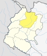
Bajhang District
Geography and climate
The district is surrounded by Bajura and Humla in the East, Baitadi and Darchula in the West, Humla in the North and Doti and Achham in the South. The district is located between 29°29' and 30°09' north longitude, and 80°46' and 81°34 east latitude. The elevation of the district from sea level is 900 metres (3,000 ft) to 7,035 metres (23,081 ft).
| Climate Zone | Elevation Range | % of Area |
|---|---|---|
| Upper Tropical | 300 to 1,000 meters 1,000 to 3,300 ft. |
0.5% |
| Subtropical | 1,000 to 2,000 meters 3,300 to 6,600 ft. |
18.0% |
| Temperate | 2,000 to 3,000 meters 6,400 to 9,800 ft. |
26.5% |
| Subalpine | 3,000 to 4,000 meters 9,800 to 13,100 ft. |
16.6% |
| Alpine | 4,000 to 5,000 meters 13,100 to 16,400 ft. |
8.4% |
| Nival | above 5,000 meters | 30.0% |
Major religious spots
- Khaptad Baba Mandir
- Devisthan Mandir, Chainpur (HQ of Bajhang District)
- Chuli Tika, Chabbis
- Ram mandir, Kada
- Surma Sarowar, Surma
- Khulmour Kedar Mandir (kedarnath)
- Thali, Durga thali Municipality
- Baddi jyaban, Purumchuli Siddanath, Bungle Municipality
Demographics
At the time of the 2011 Nepal census, Bajhang District had a population of 195,159.
As first language, 75.5% spoke Nepali, 23.6% Bajhangi, 0.5% Doteli, 0.2% Dhuleli, 0.1% Gurung, 0.1% Tamang and 0.1% other languages.
Ethnicity/caste: 66.6% were Chhetri, 10.2% Hill Brahmin, 7.3% Kami, 5.1% other Dalit, 4.9% Thakuri, 2.2% Sarki, 1.5% Damai/Dholi, 1.2% Sanyasi/Dasnami, 0.2% Badi, 0.1% Gurung, 0.1% Magar, 0.1% Newar, 0.1% Tamang, 0.1% other Terai and 0.1% others.
Religion: 99.7% were Hindu and 0.2% Buddhist.
Literacy: 55.4% could read and write, 3.2% could only read and 41.3% could neither read nor write.
| Census year | Pop. | ±% p.a. | ||
|---|---|---|---|---|
| 1981 | 124,010 | — | ||
| 1991 | 139,092 | +1.15% | ||
| 2001 | 167,026 | +1.85% | ||
| 2011 | 195,159 | +1.57% | ||
| 2021 | 189,097 | −0.32% | ||
| ||||
| Source: Citypopulation | ||||
Administration
The district consists of twelve municipalities, out of which two are urban municipalities and ten are rural municipalities. These are as follows:
- Jaya Prithvi Municipality
- Bungal Municipality
- Talkot Rural Municipality
- Masta Rural Municipality
- Khaptadchhanna Rural Municipality
- Thalara Rural Municipality
- Bitthadchir Rural Municipality
- Surma Rural Municipality
- Chhabis Pathibhera Rural Municipality
- Durgathali Rural Municipality
- Kedarsyu Rural Municipality
- Saipal Rural Municipality
Prior to the restructuring of the district, Bajhang District consisted of the following municipalities and Village development committees:

- Banjh
- Bagthala
- Bhairabnath
- Bhamchaur
- Bhatekhola
- Byasi
- Chaudhari
- Dahabagar
- Dangaji
- Dantola
- Daulichaur
- Deulekh
- Deulikot
- Dhamena
- Gadaraya
- Jaya Prithvi Municipality
- Kadal
- Kailash
- Kalukheti
- Kanda
- Kaphalaseri
- Khiratadi
- Koiralakot
- Kot Bhairab
- Kotdewal
- Lamatola
- Lekhgaun
- Majhigaun
- Malumela
- Mashdev
- Matela
- Maulali
- Melbisauni
- Parakatne
- Patadewal
- Pauwagadhi
- Pitatola
- Pipalkot
- Rayal
- Rilu
- Sainpasela
- Sunikot
- Sunkuda
- Surma
- Syandi
- Thalara
References
- ^ "National Population and Housing Census 2011(National Report)" (PDF). Central Bureau of Statistics. Government of Nepal. November 2012. Archived from the original (PDF) on 18 April 2013. Retrieved 20 June 2015.
- ^ "Bajhang District (Municipality profile)" (PDF). cbs.gov.np (in Nepali). Central Bureau of Statistics. 2018. pp. 4, 5. Retrieved 9 February 2020.
- ^ The Map of Potential Vegetation of Nepal – a forestry/agroecological/biodiversity classification system (PDF), . Forest & Landscape Development and Environment Series 2-2005 and CFC-TIS Document Series No.110., 2005, ISBN 87-7903-210-9, retrieved 22 November 2013
- ^ NepalMap Language
- ^ NepalMap Caste
- ^ NepalMap Religion
- ^ NepalMap Literacy
- ^ "NEPAL: Administrative Division". www.citypopulation.de.
- ^ "स्थानिय तह" (in Nepali). Ministry of Federal Affairs and General Administration. Archived from the original on 31 August 2018. Retrieved 1 September 2018.
29°33′N 81°12′E / 29.550°N 81.200°E
