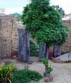
Ballowal
Geography
Ballowal is located at 30°46′11″N 75°44′52″E / 30.769661°N 75.747771°E. It has an average elevation of 246 metres (807 ft).
Climate
Ballowal features a semiarid climate under the Köppen climate classification, with three defined seasons; summer, monsoon and winter. Summers, which range from April through June in the village, tends to be very hot and very dry with average highs in May and June hovering around 40 degrees Celsius. The monsoon season which runs from July through September, sees a slight decrease in average temperatures but an increase in humidity. The bulk of the village's annual precipitation is received during the monsoon season. October and November is dry; more similar to a summer month than a monsoon month, though November is noticeably cooler than a summer month. Average temperatures though tend to decrease during the course of each of these months. December through February, which forms the winter months, is relatively mild with warm days and chilly nights. March is more of a sharp transitional month from winter to summer. Ballowal on average sees roughly 730 mm of precipitation annually.
Photo gallery
-
Old House
-
Govt. School
-
New Bridge
-
Gurdwara Sahib
-
Old Mile Stone
-
Aata Chakki
-
Rajbaha Opener Key
-
Rainy Season
-
Playing Cards
-
Old Man
-
Old Charkha
-
Kassi wala Raah
-
Historical Gate
-
Desi Playground
-
Old Culture
-
Baba Gajjan Singh
-
Children Diving in Canal
References
- ^ "Ballowal". census2011.co.in. Retrieved 10 July 2016.


