Barren Township, Jackson County, Arkansas
Barren Township is a township in Jackson County, Arkansas, United States. Its total population was 910 as of the 2010 United States Census, an increase of 6.93 percent from 851 at the 2000 census.
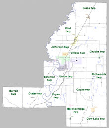
Townships in Jackson County as of 2010

According to the 2010 Census, Barren Township is located at 35°29′17″N 91°32′23″W / 35.487941°N 91.539853°W (35.487941, -91.539853). It has a total area of 35.435 square miles (91.78 square kilometers), of which 35.422 sq mi (91.74 km) is land and 0.013 sq mi (0.034 km) is water (0.04%). As per the USGS National Elevation Dataset, the elevation is 614 feet (187 m).
References
- ^ "County Subdivisions (2010): Arkansas". 2010 Census Gazetteer Files. United States Census Bureau. Archived from the original (TXT) on May 31, 2014. Retrieved May 31, 2014.
- ^ "Feature ID 66717: Township of Barren (Jackson County, Arkansas)". Geographic Names Information System. United States Geological Survey. Retrieved May 31, 2014.
- ^ "FIPS55 Data: Arkansas". FIPS55 Data. United States Geological Survey. February 23, 2006. Archived from the original (TXT) on June 18, 2006. Retrieved May 31, 2014.
- ^ "Summary Population and Housing Characteristics, CPH-1-5, Arkansas" (PDF). 2010 Census of Population and Housing. United States Census Bureau. September 2012. Retrieved May 31, 2014.
- ^ "2010 Demographic Profile (DP-1): Barren township, Jackson County, Arkansas". American FactFinder. United States Census Bureau. Archived from the original on February 12, 2020. Retrieved May 31, 2014.
- ^ "2000 Demographic Profile (DP-1): Barren township, Jackson County, Arkansas". American FactFinder. United States Census Bureau. Archived from the original on February 12, 2020. Retrieved May 31, 2014.
- ^ "County Subdivisions (2000)". 2000 Census Gazetteer Files. United States Census Bureau. Archived from the original (Zipped TXT) on May 31, 2014. Retrieved May 31, 2014.
External links
- "2010 Census Block Map: Barren Township, Arkansas" (PDF). Arkansas 2010 Census Block Maps - County Subdivisions. U.S. Census Bureau.
- "2013 Boundary and Annexation Survey (BAS) Map: Jackson County, Arkansas" (PDF). Boundary and Annexation Survey (BAS) Shapefiles and Maps. U.S. Census Bureau. Archived from the original (PDF) on March 4, 2016. Retrieved June 1, 2014.
- "2010 Census County Subdivision Maps: Arkansas" (PDF). County Subdivision Maps. U.S. Census Bureau.
Municipalities and communities of Jackson County, Arkansas, United States | ||
|---|---|---|
| Cities |  | |
| Towns | ||
| Unincorporated communities | ||
| Ghost town | ||
This article about a location in Jackson County, Arkansas is a stub. You can help Wikipedia by expanding it. |