Bermejo, Bolivia
Bermejo is a city in Bolivia, south of the Tariquía Flora and Fauna National Reserve. It is in a broad, open valley of the Cordillera Central range that extends southward into Argentina, and is on the Bermejo River, locally the border between Bolivia and Argentina.
It is served by Bermejo Airport.
-
 Colonial church in Bermejo
 -
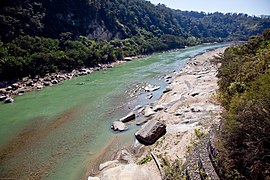 Bermejo River

_y_Argentina_(dcha).jpg)
Climate
| Climate data for Bermejo (Bermejo Airport), elevation 385 m (1,263 ft) | |||||||||||||
|---|---|---|---|---|---|---|---|---|---|---|---|---|---|
| Month | Jan | Feb | Mar | Apr | May | Jun | Jul | Aug | Sep | Oct | Nov | Dec | Year |
| Mean daily maximum °C (°F) | 33.2 (91.8) |
32.2 (90.0) |
30.3 (86.5) |
27.0 (80.6) |
23.9 (75.0) |
21.4 (70.5) |
22.7 (72.9) |
25.7 (78.3) |
29.3 (84.7) |
32.4 (90.3) |
32.5 (90.5) |
33.5 (92.3) |
28.7 (83.6) |
| Daily mean °C (°F) | 27.1 (80.8) |
26.4 (79.5) |
24.9 (76.8) |
22.1 (71.8) |
18.9 (66.0) |
16.0 (60.8) |
16.0 (60.8) |
18.2 (64.8) |
21.3 (70.3) |
25.0 (77.0) |
25.8 (78.4) |
27.0 (80.6) |
22.4 (72.3) |
| Mean daily minimum °C (°F) | 20.9 (69.6) |
20.6 (69.1) |
19.6 (67.3) |
17.2 (63.0) |
13.9 (57.0) |
10.6 (51.1) |
9.4 (48.9) |
10.7 (51.3) |
13.4 (56.1) |
17.7 (63.9) |
19.2 (66.6) |
20.6 (69.1) |
16.2 (61.1) |
| Average precipitation mm (inches) | 199.8 (7.87) |
197.6 (7.78) |
179.3 (7.06) |
96.0 (3.78) |
29.0 (1.14) |
13.8 (0.54) |
12.7 (0.50) |
5.4 (0.21) |
16.5 (0.65) |
59.6 (2.35) |
108.5 (4.27) |
179.9 (7.08) |
1,098.1 (43.23) |
| Average precipitation days | 11.0 | 10.3 | 11.3 | 9.6 | 5.1 | 3.9 | 2.5 | 1.6 | 2.2 | 5.6 | 8.1 | 9.9 | 81.1 |
| Average relative humidity (%) | 73.7 | 77.4 | 80.4 | 82.0 | 79.8 | 80.1 | 74.2 | 67.2 | 61.1 | 62.6 | 67.3 | 70.6 | 73.0 |
| Source: Servicio Nacional de Meteorología e Hidrología de Bolivia | |||||||||||||
References
- ^ "Google Maps". Google Maps. Retrieved 25 April 2016.
- ^ OpenStreetMap - Bermejo
- ^ "Base de datos Sistema Meteorológico–SISMET" (in Spanish). Servicio Nacional de Meteorología e Hidrología de Bolivia. Archived from the original on 7 June 2018. Retrieved 12 June 2024.
- ^ "índices climáticos para 149 estaciones meteorológicas en Bolivia" (in Spanish). Servicio Nacional de Meteorología e Hidrología de Bolivia. Retrieved 12 June 2024.
External links
- Account of a trip to the city of Bermejo in 2016 (in Spanish)