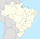
Brazlândia
Geography
Brazlandia has a tropical savanna climate (Aw, according to the Köppen climate classification). In general, the temperature ranges from 14 °C to 30 °C and is rarely lower than 10 °C or higher than 30 °C. Most of the year the climate is warm and pleasant, and this continues between August and October, with an average daily maximum temperature of over 22 °C. The hottest month of the year is October, with a maximum of 29 °C and a minimum of 18 °C on average.
Transportation
The main access road to Brazlândia is the Expresso São José 27, and the main highways that access the administrative region are the Estrada Parque do Contorno - EPCT (DF-001), DF-170, DF-180, DF-206, DF-220 and DF-240, BR-251, as well as the Federal Highway BR-080 which connects to the Belém-Brasília highway, shortening access to the north and south of the country by approximately 300 km. In other words, Brazlândia is a hub for the country's North and South National Integration Hubs.
See also
References
- ^ "Perfil do administrador" (in Portuguese). Administração Regional de Brazlândia, DF. Retrieved 2015-01-01.
- ^ "Pesquisa Distrital por Amostra de Domicílios - 2010/2011" (PDF) (in Portuguese). Codeplan. Retrieved 2013-04-09.
- ^ "CONFIRA PROGRAMAÇÃO DE ANIVERSÁRIO DE 90 ANOS DE BRAZLÂNDIA – Administração Regional de Brazlândia" (in Brazilian Portuguese). Retrieved 2023-11-18.
- ^ "Brazlândia comemora 90 anos com investimentos e programação festiva especial; confira". 84 Notícias (in Brazilian Portuguese). 2023-06-04. Retrieved 2023-11-18.
- ^ Morais, Jéssica (2022-06-25). "UNB. ESTUDO E REFLEXÕES SOBRE O PLANEJAMENTO OPERACIONAL DO SISTEMA DE TRANSPORTE PÚBLICO POR ÔNIBUS: Estudo de Caso da Região Administrativa de Brazlândia, DF" (PDF). UnB. Retrieved 2023-11-18.
