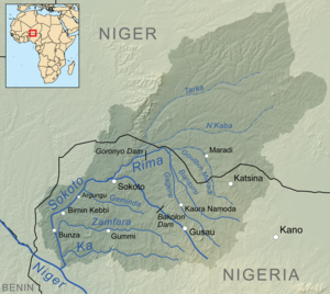
Bunza
It has an area of 876 square kilometers and a 2006 population of 121,461 census .
The postal code of the area is 862.
Geography
Bunza local government area spans an entire expanse of 876 square kilometers and experiences two significant seasons, the dry season and the rainy season. The average temperature in Bunza registers at 33°C, while the area's humidity level is estimated to be around 17 percent.
Economy
In Bunza local government area, a variety of crops are grown, which encompass groundnuts, rice, millet, sorghum, and onions. Additionally, key economic engagements in Bunza involve hunting, trade, and metalwork.
Climate
With an average yearly temperature of 31.37°C, the district of Bunza has a tropical wet and dry climate, which is 1.91% warmer than the national average for Nigeria.
Temperature fluctuations and a growing average temperature point to a favourable trend in Bunza's direction.

References
- ^ 2006 census
- ^ "Post Offices- with map of LGA". NIPOST. Archived from the original on 2009-10-07. Retrieved 2009-10-20.
- ^ "Bunza Local Government Area". www.manpower.com.ng. Retrieved 2023-10-03.
- ^ "Bunza, Kebbi, NG Climate Zone, Monthly Averages, Historical Weather Data". tcktcktck.org. Retrieved 2023-09-10.
- ^ "Bunza Climate, Weather By Month, Average Temperature (Nigeria) - Weather Spark". weatherspark.com. Retrieved 2023-09-10.
- ^ "Climate Change Bunza". meteoblue. Retrieved 2023-10-22.
12°05′30″N 4°00′39″E / 12.0916°N 4.0108°E
