City Of Sheffield
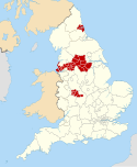
The current city boundaries were set on 1 April 1974 by the provisions of the Local Government Act 1972, as part of a reform of local government in England. The city is a merger of two former local government districts; the unitary City and County Borough of Sheffield combined with the urban district of Stocksbridge and parts of the rural district of Wortley from the West Riding of Yorkshire.
For its first 12 years, the city had a two-tier system of local government; Sheffield City Council shared power with South Yorkshire County Council. Since the Local Government Act 1985 Sheffield City Council has effectively been a unitary authority, serving as the sole executive, deliberative and legislative body responsible for local policy, setting council tax, and allocating budget in the city, and is a member of the Sheffield City Region Partnership. The City of Sheffield is divided into three civil parishes and a single unparished area.
Geography
The present city boundaries were set in 1974 (with slight modification in 1994), when the former county borough of Sheffield merged with Stocksbridge Urban District and two parishes from the Wortley Rural District. This area includes a significant part of the countryside surrounding the main urban region. Roughly a third of Sheffield lies in the Peak District National Park. No other English city had parts of a national park within its boundary, until the creation in March 2010 of the South Downs National Park, part of which lies within Brighton and Hove.
-
Gleadless Valley, demonstrating the hilly terrain within the city
Governance
Sheffield City Council is the local authority for the district. The council is composed of 84 councillors, three for each of the city's 28 wards. It is currently under No Overall Control. The city was under Labour control from its creation until 1999, when the Liberal Democrats took control of the council. The Labour Party regained control of the council in 2002 with power shifting back to the Liberal Democrats in 2008. However, Labour took control once again in 2011. Following the 2021 elections, the council is now in No Overall Control. As a metropolitan county, South Yorkshire does not have a county council, so Sheffield City Council is the primary provider of local government services. The district forms part of the Yorkshire and the Humber region of England.
The area of the former county borough of Sheffield is unparished with no lower tier of government and there are three civil parishes with parish councils, the lowest tier of local government. The civil parishes are: Bradfield, Ecclesfield and Stocksbridge.
The district is represented by five MPs, for the constituencies of Sheffield Brightside and Hillsborough, Sheffield Central, Sheffield Hallam, Sheffield Heeley, and Sheffield South East, all currently represented by Labour. The constituency of Penistone and Stocksbridge is partially in the City of Sheffield and is also represented by the Labour Party.
Demography
The latest (2022) population estimate for the City of Sheffield is 566,242 residents.
Transport
Parts of the city are covered by the Sheffield Supertram light rail tram network.
References
- ^ "Sheffield, Yorkshire and the Humber". Ordnance Survey. Retrieved 1 March 2024.
- ^ "Your City Council". Sheffield City Council. Retrieved 1 March 2024.
- ^ "Mid-Year Population Estimates, UK, June 2022". Office for National Statistics. 26 March 2024. Retrieved 3 May 2024.
- ^ "Mid-Year Population Estimates, UK, June 2022". Office for National Statistics. 26 March 2024. Retrieved 3 May 2024.
- ^ UK Census (2021). "2021 Census Area Profile – Sheffield Local Authority (E08000019)". Nomis. Office for National Statistics. Retrieved 1 March 2024.
- ^ Fenton, Trevor (25 April 2023). "Regional gross domestic product: local authorities". Office for National Statistics. Retrieved 1 March 2024.
- ^ Van den Berg 2006, p. 179.
- ^ "Local Government Act 1972". legislation.gov.uk. Retrieved 1 July 2022.
- ^ "City Profile Introduction". Sheffield City Council. 31 January 2013. Archived from the original on 19 October 2014. Retrieved 13 October 2013.
- ^ "New village officer will boost rural communities". Peak District National Park Authority. 22 June 2009. Archived from the original on 20 July 2011. Retrieved 7 August 2009.
- ^ "Yorkshire and the Humber Local Authority districts and parishes". CityPopulation.de. Retrieved 15 May 2021.
- ^ "Sheffield Resident Population Estimates by Ethnic Group and Sex, All Persons". National Statistics: Neighbourhood Statistics. Retrieved 25 October 2009.
Bibliography
- Van den Berg, Leo (2006). The Safe City: Safety and Urban Development in European Cities. Ashgate. ISBN 978-0-7546-4723-2.


