Cyretiae

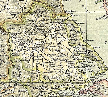
Cyretiae or Chyretiai or Kyretiai (Greek: Χυρετίαι) was a town and polis (city-state) of Perrhaebia in ancient Thessaly, frequently mentioned in the Roman wars in Greece. It was plundered by the Aetolians in 200 BCE, was taken by Antiochus III, 191 BCE, but recovered by Marcus Baebius Tamphilus and Philip V of Macedon in the same year, and was attacked by Perseus of Macedon, following the surrender of nearby Doliche, Pythium, and Azorus in 171 BCE. In the last event, after a first assault attempt was repulsed, the attackers on the second day of the siege obtained the surrender of the defenders.
Cyretiae appears in several inscriptions that have come down to us, among which stand out: one dated between 375-350 BCE, containing a joint dedication to Apollo of the cities of Perrhaebia, a letter from Titus Quinctius Flamininus to the Cyretiaeans that can be dated to 195 BCE, and a decree of proxeny dated to 191 BCE that contains the names of several tagoi.
Cyretiae is located at a site in the modern village of Domeniko. Its acropolis occupied the hill, on which now stands the church of St. George, and excavations have been undertaken.
References
- ^ Ptolemy. The Geography. Vol. 3.13.44.
- ^ Mogens Herman Hansen & Thomas Heine Nielsen (2004). "Thessaly and Adjacent Regions". An inventory of archaic and classical poleis. New York: Oxford University Press. p. 722. ISBN 0-19-814099-1.
- ^ Livy. Ab urbe condita Libri [History of Rome]. Vol. 31.41.
- ^ Livy. Ab urbe condita Libri [History of Rome]. Vol. 36.10, 13.
- ^ Livy. Ab urbe condita Libri [History of Rome]. Vol. 42.53.
- ^ Jorge Martínez de Tejada Garaizábal, Instituciones, sociedad, religión y léxico de Tesalia de la antigüedad desde la época de la independencia hasta el fin de la edad antigua (siglos VIII AC-V DC), tesis doctoral, pp.235. Madrid: Universidad Complutense de Madrid (2012). Archived 2018-08-29 at the Wayback Machine (in Spanish)
- ^ Lund University. Digital Atlas of the Roman Empire.
- ^ Richard Talbert, ed. (2000). Barrington Atlas of the Greek and Roman World. Princeton University Press. p. 55, and directory notes accompanying. ISBN 978-0-691-03169-9.
- ^
 Smith, William, ed. (1854–1857). "Cyretiae". Dictionary of Greek and Roman Geography. London: John Murray.
![]() This article incorporates text from a publication now in the public domain: Smith, William, ed. (1854–1857). "Cyretiae". Dictionary of Greek and Roman Geography. London: John Murray.
This article incorporates text from a publication now in the public domain: Smith, William, ed. (1854–1857). "Cyretiae". Dictionary of Greek and Roman Geography. London: John Murray.