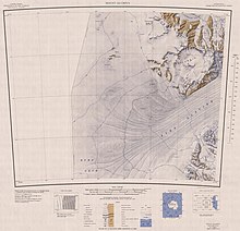
Derrick Peak
Name
Derrick Peak was named by the Advisory Committee on Antarctic Names for Robert O. Derrick of the United States Weather Bureau, who served as assistant to the United States Antarctic Research Program Representative at Christchurch from 1960 until his death in 1966.
Location

Derrick Peak is in the north of the Britannia Range, overlooking the Hatherton Glacier to the north, which forms the boundary with the Darwin Mountains. It is east of a line of relatively ice-free valleys and ridges along the south side of Hatherton Glacier, north of Mount Henderson and west of Johnstone Ridge and Dusky Ridge. Most of the nearby features were named in association with Britannia by a University of Waikato (New Zealand) geological party, 1978-79, led by M.J. Selby.
Western features
Nearby features to the west include:
Lindum Valley
80°03′S 155°58′E / 80.050°S 155.967°E. Ice-filled valley that opens northward to Hatherton Glacier, lying 5 nautical miles (9.3 km; 5.8 mi) west-northwest of Derrick Peak. Lindum is an old Roman place name for present-day Lincoln.
Magnis Valley
80°05′S 156°05′E / 80.083°S 156.083°E. Broad ice-free valley, 5 nautical miles (9.3 km; 5.8 mi) long, lying 3 nautical miles (5.6 km; 3.5 mi) west of Derrick Peak. Magnis is a historical place name formerly used in Roman Britain.
Magnis Ridge
80°05′S 156°12′E / 80.083°S 156.200°E. A rock ridge 1.5 nautical miles (2.8 km; 1.7 mi) west of Derrick Peak, forming the divide between Magnis Valley and Metaris Valley. Named in association with Magnis Valley.
DeGalan Peak
80°07′00″S 155°55′00″E / 80.1166667°S 155.9166667°E. A peak that rises to 2,470 metres (8,100 ft) at the head of Magnis Valley. Named after Lee DeGalan, contractor employee in charge of U.S. Antarctic Project (USAP) cargo shipments out of Port Hueneme, CA, for more than 20 years.
Metaris Valley
80°05′S 156°17′E / 80.083°S 156.283°E. A small, rounded cirque valley with steep sides and residual névé, lying west of Derrick Peak. Named in association with Britannia by a University of Waikato (N.Z.) geological party, 1978-79, led by M.J. Selby. Metaris is the historical name of a bay in Roman Britain, known today as The Wash.
Southern features
Nearby features to the south include:
Onnum Valley
80°06′S 156°21′E / 80.1°S 156.35°E An ice-free valley between Derrick Peak and Onnum Ridge. Named in association with Onnum Ridge.
Operose Peak
80°06′00″S 156°14′00″E / 80.1°S 156.2333333°E A peak above Onnum Valley to the southwest of Derrick Peak. The steep lower slopes of the peak are of Beacon sandstone; the top, 2,130 metres (6,990 ft) high, is made up of a thick dolerite sill. The Latin name means laborious or requiring great pain reflecting the steepness of the slopes.
Onnum Ridge
80°07′S 156°25′E / 80.117°S 156.417°E. A mountain spur that descends northeast to McCraw Glacier, 3 nautical miles (5.6 km; 3.5 mi) south of Derrick Peak. Onnum is a historical placename formerly used in Roman Britain.
Pontes Ridge
80°08′S 156°24′E / 80.133°S 156.400°E. A mountain spur that descends eastward to McCraw Glacier, 4 nautical miles (7.4 km; 4.6 mi) south of Derrick Peak. Pontes is a historical place name formerly used in Roman Britain.
Sabrina Valley
80°09′S 156°22′E / 80.150°S 156.367°E. An ice-free valley between Pontes Ridge and Sabrina Ridge. Named in association with Sabrina Ridge.
Sabrina Ridge
80°09′S 156°20′E / 80.150°S 156.333°E. A bare rock ridge between Sabrina Valley and Tamarus Valley, 5 nautical miles (9.3 km; 5.8 mi) south of Derrick Peak. Sabrina is a historical name formerly used in Roman Britain for the River Severn.
References
- ^ Alberts 1995, p. 184.
- ^ Mount Olympus USGS.
- ^ Alberts 1995, p. 435ff, Lindum Valley etc..
- ^ Alberts 1995, p. 435.
- ^ Alberts 1995, p. 456.
- ^ Alberts 1995, p. 455.
- ^ DeGalan Peak USGS.
- ^ Alberts 1995, p. 487.
- ^ Onnum Valley USGS.
- ^ Operose Peak USGS.
- ^ Alberts 1995, p. 545.
- ^ Alberts 1995, p. 583.
- ^ Alberts 1995, p. 641.
Sources
- Alberts, Fred G., ed. (1995), Geographic Names of the Antarctic (PDF) (2 ed.), United States Board on Geographic Names, retrieved 2023-12-03
 This article incorporates public domain material from websites or documents of the United States Board on Geographic Names.
 - "DeGalan Peak", Geographic Names Information System, United States Geological Survey, United States Department of the Interior
- Mount Olympus, USGS United States Geologic Survey, 1960, retrieved 2024-03-12
- "Onnum Valley", Geographic Names Information System, United States Geological Survey, United States Department of the Interior
- "Operose Peak", Geographic Names Information System, United States Geological Survey, United States Department of the Interior
![]() This article incorporates public domain material from websites or documents of the United States Geological Survey.
This article incorporates public domain material from websites or documents of the United States Geological Survey.