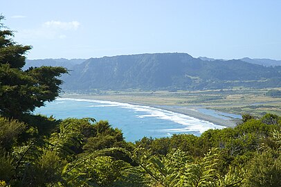
East Cape (New Zealand)
The name "East Cape" is also used for the part of the Gisborne District north of the Poverty Bay area, but more often as a metonym for the whole Gisborne District.
Maritime New Zealand operates the East Cape Lighthouse, located at the cape's easternmost point. The small East Island / Whangaokeno, also known as Motu o Kaiawa, is directly offshore. The NZ Transport Agency upgraded the Horoera Bridge in 2017, giving campervans and other heavy vehicles full access to the lighthouse. It replaced a temporary Bailey bridge installed in 2015.
-
Te Araroa and ranges towards East Cape
-
Looking from East Cape towards East Island / Whangaokeno
Demographics
East Cape statistical area, which includes Wharekahika / Hicks Bay, Te Araroa and Tikitiki, covers 991.22 km (382.71 sq mi) and had an estimated population of 1,560 as of June 2024, with a population density of 1.6 people per km.
| Year | Pop. | ±% p.a. |
|---|---|---|
| 2006 | 1,563 | — |
| 2013 | 1,419 | −1.37% |
| 2018 | 1,389 | −0.43% |
| Source: | ||
East Cape had a population of 1,389 at the 2018 New Zealand census, a decrease of 30 people (−2.1%) since the 2013 census, and a decrease of 174 people (−11.1%) since the 2006 census. There were 462 households, comprising 735 males and 654 females, giving a sex ratio of 1.12 males per female. The median age was 39.8 years (compared with 37.4 years nationally), with 360 people (25.9%) aged under 15 years, 213 (15.3%) aged 15 to 29, 603 (43.4%) aged 30 to 64, and 210 (15.1%) aged 65 or older.
Ethnicities were 22.7% European/Pākehā, 91.6% Māori, 2.2% Pacific peoples, 0.6% Asian, and 1.1% other ethnicities. People may identify with more than one ethnicity.
The percentage of people born overseas was 2.4, compared with 27.1% nationally.
Although some people chose not to answer the census's question about religious affiliation, 41.9% had no religion, 41.0% were Christian, 5.2% had Māori religious beliefs, 0.2% were Muslim, 0.2% were Buddhist and 0.6% had other religions.
Of those at least 15 years old, 105 (10.2%) people had a bachelor's or higher degree, and 294 (28.6%) people had no formal qualifications. The median income was $18,500, compared with $31,800 nationally. 48 people (4.7%) earned over $70,000 compared to 17.2% nationally. The employment status of those at least 15 was that 297 (28.9%) people were employed full-time, 171 (16.6%) were part-time, and 105 (10.2%) were unemployed.
References
- ^ Hariss, Gavin. "East Cape, Gisborne". topomap.co.nz. NZ Topo Map.
- ^ "Chart of New Zealand – J Cook 1769–70". 1770.
- ^ Soutar, Monty (1 March 2015). "East Coast region – Overview". Te Ara – the Encyclopedia of New Zealand. Ministry for Culture and Heritage. Retrieved 28 August 2023.
- ^ East Cape Lighthouse Archived 14 May 2010 at the Wayback Machine, Maritime New Zealand. Retrieved 1 December 2009.
- ^ Also known as Motu o Kaiawa, see Kate MacIntyre, Te Whanau a Apanui and the East Coast Inquiry District Archived 23 April 2019 at the Wayback Machine, Waitangi Tribunal Scoping Report, Wai 900 #A9, p. 37.
- ^ East Island / Whangaokeno, Rodent Invasion Project, Department of Statistics, University of Auckland. Retrieved 1 December 2009.
- ^ "Dropout delays bridge rebuild". Gisborne Herald. 24 July 2017. Archived from the original on 18 May 2019. Retrieved 18 May 2019.
- ^ "Bridging the gap to East Cape Lighthouse". Gisborne Herald. 17 August 2017. Archived from the original on 18 May 2019. Retrieved 18 May 2019.
- ^ Ashton, Andrew (3 December 2015). "East Coast Lighthouse opens up for freedom campers". Gisborne Herald. Archived from the original on 1 February 2016. Retrieved 18 May 2019.
- ^ "ArcGIS Web Application". statsnz.maps.arcgis.com. Retrieved 2 November 2023.
- ^ "Aotearoa Data Explorer". Statistics New Zealand. Retrieved 26 October 2024.
- ^ "Statistical area 1 dataset for 2018 Census". Statistics New Zealand. March 2020. East Cape (204700). 2018 Census place summary: East Cape

