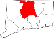
Elmwood, West Hartford
History
As with the rest of West Hartford, Elmwood was mostly rural and sparsely populated, consisting of farmland and agriculture, until suburban residential development unfolded throughout the 20th century. Once home to a substantial Irish and Italian American community, Elmwood today is West Hartford's most racially diverse section of town.
Education
Public schools
- Charter Oak International Academy
- Wolcott Elementary School
Infrastructure
Elmwood's main thoroughfares include New Britain Avenue, Newington Road and New Park Avenue. The commercial section of New Britain Avenue is known as Elmwood Center, an area composed of local businesses, services, and restaurants. Newington Road and New Park Avenue are formerly areas where the manufacturing sector thrived in previous decades and have experienced steady revitalizations in recent years. Elmwood is the site of the former Talcott Middle School, which has since been renovated into luxury condominiums. It is also home to Beachland Park and the southernmost point of the town's Trout Brook Trail.
Elmwood is a stop on CTfastrack near the intersection of New Britain Avenue and New Park Avenue.
References
- ^ Prevost, Lisa (May 4, 2008). "A Revival in a Run-Down Part of Town". New York Times. Retrieved September 11, 2019.
- ^ Ubiñas, Helen (April 3, 2011). "In Elmwood, Some See A Real Divide". Hartford Courant. Retrieved September 11, 2019.
