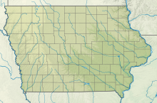
Fairfield Municipal Airport (Iowa)
Fairfield Municipal Airport | |||||||||||||||
|---|---|---|---|---|---|---|---|---|---|---|---|---|---|---|---|
| Summary | |||||||||||||||
| Airport type | Public | ||||||||||||||
| Owner | City of Fairfield | ||||||||||||||
| Serves | Fairfield, Iowa | ||||||||||||||
| Elevation AMSL | 799 ft / 244 m | ||||||||||||||
| Map | |||||||||||||||
 | |||||||||||||||
| Runways | |||||||||||||||
| |||||||||||||||
| Statistics (2005) | |||||||||||||||
| |||||||||||||||
Source: Federal Aviation Administration | |||||||||||||||
Fairfield Municipal Airport (IATA: FFL, ICAO: KFFL, FAA LID: FFL) is a public airport located three miles (5 km) northwest of the central business district of Fairfield, a city in Jefferson County, Iowa, United States. It is owned by the City of Fairfield.
Facilities and aircraft
Fairfield Municipal Airport covers an area of 118 acres (48 ha) which contains two runways: 18/36 with a concrete pavement measuring 5,500 x 100 ft (1,676 x 30 m) and 8/26 with a turf surface 2,450 x 165 ft (747 x 50 m).
For the 12-month period ending November 15, 2005, the airport had 9,380 aircraft operations, an average of 25 per day: 89% general aviation, 9% military and 2% air taxi. There are 36 aircraft based at this airport: 81% single engine, 8% multi-engine, 3% jet and 8% ultralight.
Historical aircraft
A former USAF F-84F Thunderstreak is on static display near the airport terminal.
See also
References
- ^ FAA Airport Form 5010 for FFL PDF, effective 2007-07-05
External links
- Resources for this airport:
- FAA airport information for FFL
- AirNav airport information for KFFL
- ASN accident history for FFL
- FlightAware airport information and live flight tracker
- NOAA/NWS weather observations: current, past three days
- SkyVector aeronautical chart, Terminal Procedures

