Loading
  • 21 Aug, 2019

  • By, Wikipedia

File:ÖrtzeRieselwsKarte.jpg

Germany

The photographical reproduction of this work is covered under the article § 59 of the German copyright law, which states that "It shall be permissible to reproduce, by painting, drawing, photography or cinematography, works which are permanently located on public ways, streets or places and to distribute and publicly communicate such copies. For works of architecture, this provision shall be applicable only to the external appearance."

As with all other “limits of copyright by legally permitted uses”, no changes to the actual work are permitted under § 62 of the German copyright law (UrhG).

See Commons:Copyright rules by territory/Germany#Freedom of panorama for more information.

العربية  Deutsch  English  Esperanto  español  français  한국어  македонски  português  português do Brasil  русский  українська  中文  中文(简体)  中文(繁體)  +/−

Original upload log

The original description page was here. All following user names refer to de.wikipedia.
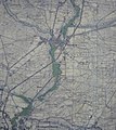
  • 2009-05-21 15:13 Hajotthu 2495×2789× (3009253 bytes) {{Information |Beschreibung = Bild aus der öffentlich aufgestellten Infotafel: Übersichtskarte der Rieselwiesen zwischen Müden und Hermannsburg |Quelle = eigenes Foto |Urheber = ~~~~ |Datum = Mai 2009 |Genehmigung = |Andere Versionen = |Anmerkungen =

Captions

Add a one-line explanation of what this file represents

Items portrayed in this file

depicts

May 2009

0.03333333333333333333 second

5.2 millimetre

File history

Click on a date/time to view the file as it appeared at that time.

Date/TimeThumbnailDimensionsUserComment
current11:26, 10 August 2019Thumbnail for version as of 11:26, 10 August 20192,495 × 2,789 (5.76 MB)HajotthuHelligkeit und Konetrast verbessert
20:04, 31 March 2010Thumbnail for version as of 20:04, 31 March 20102,495 × 2,789 (2.87 MB)Bermicourt{{Information |Description={{de|Bild aus der öffentlich aufgestellten Infotafel: Übersichtskarte der Rieselwiesen zwischen Müden und Hermannsburg}} {{en|Photo of the publicly displayed information board: Overview map of the irrigated meadows between M�
The following pages on the English Wikipedia use this file (pages on other projects are not listed):

Global file usage

The following other wikis use this file:

Metadata