File:1888 Districts Congo Free State Cropped From 1950 Administration Map Atlas General Du Congo 611.jpg
Click on a date/time to view the file as it appeared at that time.
| Date/Time | Thumbnail | Dimensions | User | Comment | |
|---|---|---|---|---|---|
| current | 14:23, 13 October 2017 | 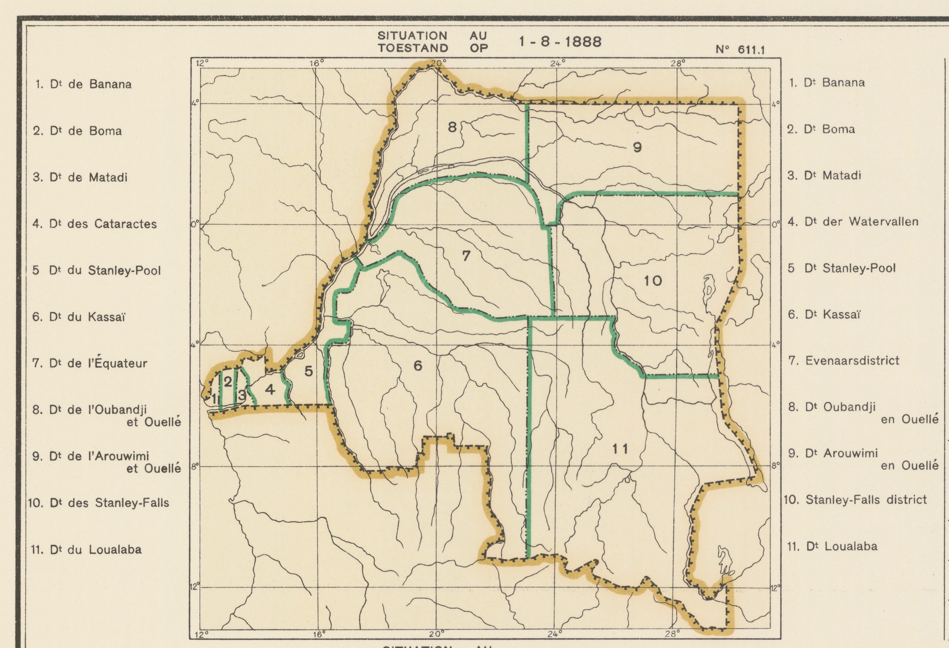 | 3,667 × 2,502 (4.94 MB) | M2545 | == {{int:filedesc}} == {{Information |Description={{fr|1=Carte des subdivisions administrative }} {{nl|1= Kaart der administratieve indelingen }} |Source={{citation |oclc=681334449 |language=fr, nl |publisher= Académie Royale des Sciences Coloniales |... |
File usage
The following pages on the English Wikipedia use this file (pages on other projects are not listed):
Global file usage
The following other wikis use this file:
- Usage on en.wikiquote.org
- Usage on es.wikipedia.org
- Usage on fr.wikipedia.org