Loading
  • 21 Aug, 2019

  • By, Wikipedia

File:ASSEMBLY CONSTITUENCY MAP - MYSORE DISTRICT.pdf


বাংলা  Deutsch  English  español  français  हिन्दी  日本語  മലയാളം  मराठी  русский  中文  中文(简体)  中文(繁體)  中文(臺灣)  +/−

This image, which was originally posted in the source indicated above, has not yet been reviewed by an administrator or reviewer to confirm that the above license is valid. See Category:Unreviewed photos of GODL-India for further instructions.

Captions

Add a one-line explanation of what this file represents

18 January 2019

application/pdf

1922abf6aa0a14d82687697071bb27c232ba5953

504,285 byte

1,752 pixel

2,479 pixel

File history

Click on a date/time to view the file as it appeared at that time.

Date/TimeThumbnailDimensionsUserComment
current09:00, 23 October 2021Thumbnail for version as of 09:00, 23 October 20212,479 × 1,752 (492 KB)Vijethnbharadwaj
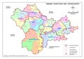
Uploaded a work by Zilla Panchayat, Mysore district https://mysore.nic.in/en/election-2019-details/ from http://164.100.238.32/photographs/mys_ac_map.pdf with UploadWizard

Global file usage

Metadata