File:Aerial-GoletaArea.jpg
Aerial photo of the Goleta area, Santa Barbara County, California — from offshore.
Date
11am
Source
Own work
Author
John Wiley User:Jw4nvc - Santa Barbara, California
Permission
(Reusing this file)
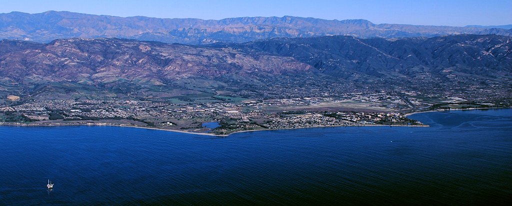
- From the left: Ellwood area, Coal Oil Point and Devereux Slough area, Isla Vista and UCSB to Campus Point, Santa Barbara Airport behind Isla Vista and UCSB with residential Goleta up into the hillside beyond and downtown Goleta at the left edge directly beyond UCSB near Hwy.101 at the base of the hills, and on the shoreline beyond Campus Point is More Mesa. At the bottom left corner offshore is Oil Platform Holly.
- Santa Ynez Mountains are in backround.
(Reusing this file)
*For full details on Permissions for this user's work, see: User:Jw4nvc/permission/details
Licensing
I, the copyright holder of this work, hereby publish it under the following license:
This file is licensed under the Creative Commons Attribution 3.0 Unported license.
- You are free:
- to share – to copy, distribute and transmit the work
- to remix – to adapt the work
- Under the following conditions:
- attribution – You must give appropriate credit, provide a link to the license, and indicate if changes were made. You may do so in any reasonable manner, but not in any way that suggests the licensor endorses you or your use.