File:Alaska Pipeline Route Near Valdez River.jpg
| Description |
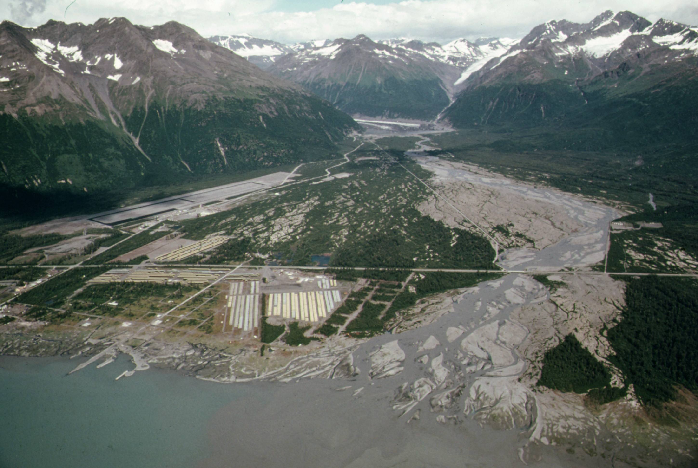
The following is the author's description of the photograph quoted directly from the photograph's Flickr page. "Original Caption: View Northeast Across Valdez River Floodplain Showing Pipe Storage Yard, Center Foreground, Which Holds 418 Miles of Pipe Yards at Fairbanks and Prudhoe Bay Hold 238 and 168 Miles of Pipe Respectively. The Community's Airport, Paved in the Summer of 1974 Sits at the Base of West Peak (Elevation 5,255 Feet). Mile 788, near the Alaska Pipeline Route 08/1974 U.S. National Archives%u2019 Local Identifier: 412-DA-13233 Photographer: Cowals, Dennis, 1945- Subjects: Alaska (United States) state Environmental Protection Agency Project DOCUMERICA Persistent URL: https://arcweb.archives.gov/arc/action/ExternalIdSearch?id=555685 Repository: Still Picture Records Section, Special Media Archives Services Division (NWCS-S), National Archives at College Park, 8601 Adelphi Road, College Park, MD, 20740-6001. For information about ordering reproductions of photographs held by the Still Picture Unit, visit: www.archives.gov/research/order/still-pictures.html Reproductions may be ordered via an independent vendor. NARA maintains a list of vendors at www.archives.gov/research/order/vendors-photos-maps-dc.html Access Restrictions: Unrestricted Use Restrictions: Unrestricted " |
||
| Date | |||
| Source |
originally posted to Flickr as View Northeast Across Valdez River Floodplain Showing Pipe Storage Yard, Center Foreground, Which Holds 418 Miles of Pipe Yards at Fairbanks and Prudhoe Bay Hold 238 and 168 Miles of Pipe Respectively...08/1974
|
||
| Author | [1] | ||
| Permission (Reusing this file) |
This file is licensed under the Creative Commons Attribution 2.0 Generic license.
|
| Annotations | This image is annotated: View the annotations at Commons |
