File:Alberta's Metis Settlements.png
Click on a date/time to view the file as it appeared at that time.
| Date/Time | Thumbnail | Dimensions | User | Comment | |
|---|---|---|---|---|---|
| current | 05:45, 1 May 2021 | 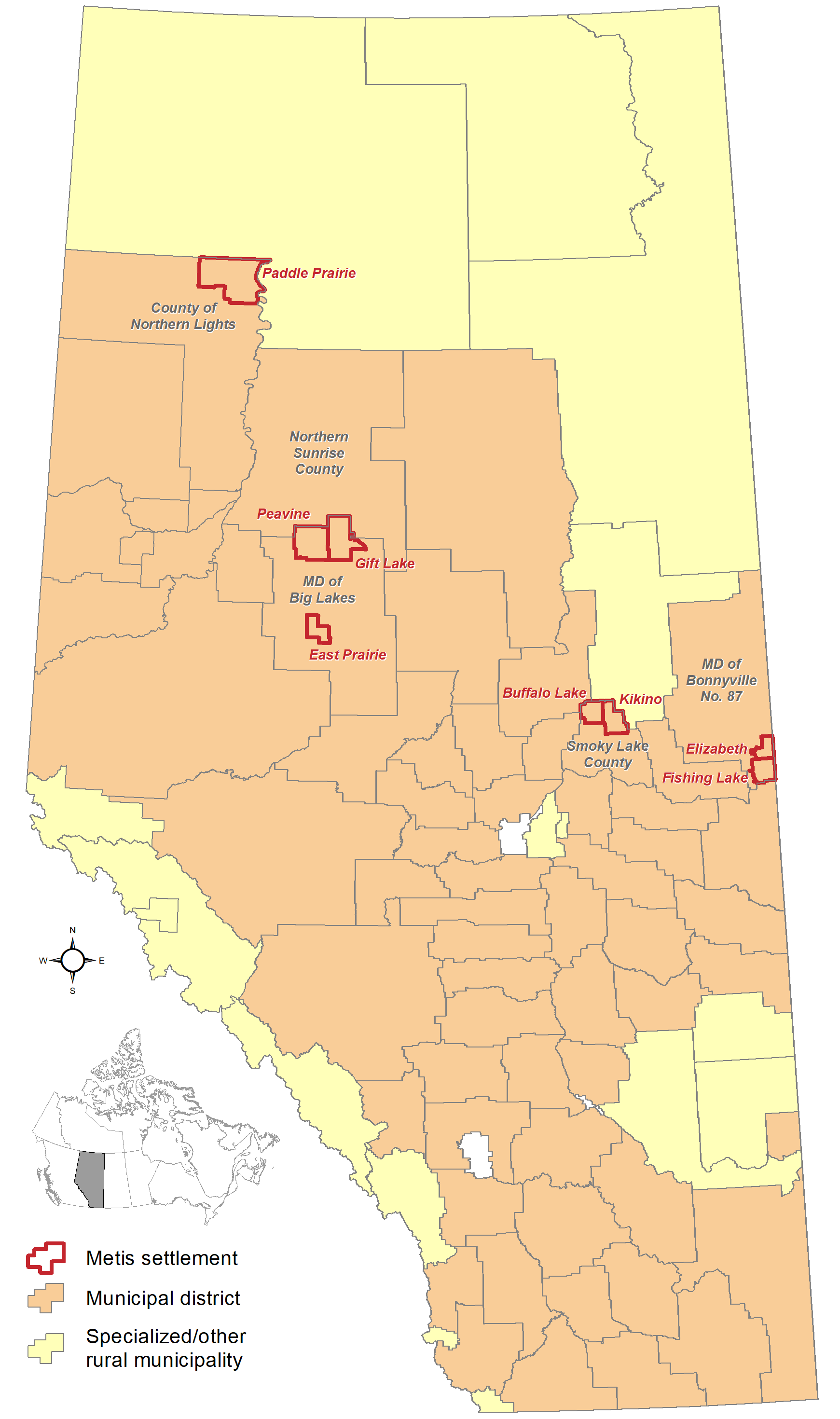 | 1,741 × 2,941 (161 KB) | Hwy43 | ID No. 349 dissolved on May 1, 2021 and was annexed to the MD of Bonnyville No. 87 |
| 19:23, 16 May 2020 |  | 1,741 × 2,941 (161 KB) | Hwy43 | forgot to remove LLBC label | |
| 19:10, 16 May 2020 |  | 1,741 × 2,941 (165 KB) | Hwy43 | LLBC now a SM | |
| 05:31, 4 November 2013 |  | 557 × 941 (50 KB) | Hwy43 | labelled Lac La Biche County and Northern Sunrise County as both are occupied by slivers of the Kikino and Gift Lake Metis settlements respectively | |
| 03:29, 31 October 2013 |  | 557 × 941 (47 KB) | Hwy43 | User created page with UploadWizard |
File usage
The following 3 pages use this file: