File:Alberta Topo Labeled 90 Dpi.png
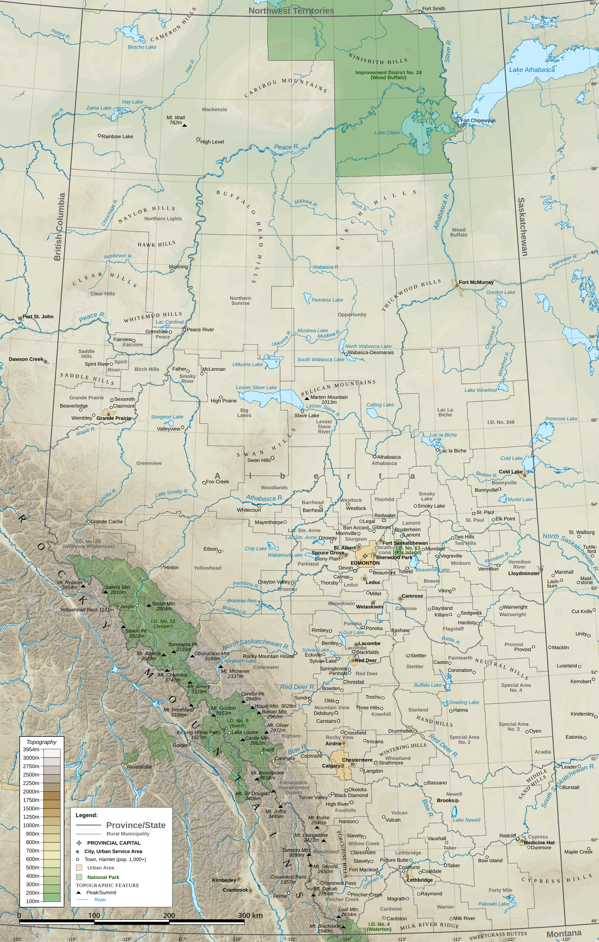
Own work (Hamlet of Granum, north of Fort Macleod, incorrectly labeled as Stavely), generated in QGIS
Author
Awmcphee
- Elevation: GMTED2010 from the USGS
- Municipalities: 2016 Census Subdivisions and Census Consolidated Subdivisions from the federal government of Canada
- Water boundary files come from the same source, except for American water bodies
- American state lines are from TIGER
Licensing
I, the copyright holder of this work, hereby publish it under the following license:
This file is licensed under the Creative Commons Attribution-Share Alike 4.0 International license.
- You are free:
- to share – to copy, distribute and transmit the work
- to remix – to adapt the work
- Under the following conditions:
- attribution – You must give appropriate credit, provide a link to the license, and indicate if changes were made. You may do so in any reasonable manner, but not in any way that suggests the licensor endorses you or your use.
- share alike – If you remix, transform, or build upon the material, you must distribute your contributions under the same or compatible license as the original.


