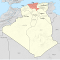
File:Alger Department 1934-1955 Map-fr.svg
This image is a derivative work of the following images:
- File:French Algeria 1934-1955 administrative map-fr.svg licensed with Cc-by-sa-3.0,2.5,2.0,1.0, FAL
- 2012-10-03T07:33:11Z Sémhur 1287x1278 (1817570 Bytes) 2 - With scale
- 2012-10-02T07:17:53Z Sémhur 1287x1278 (1817568 Bytes) == {{int:filedesc}} == {{Information |Description={{Multilingual description |en= Administrative map of [[:en:French Algeria|French Algeria]] from 1905 to 1955. Three departments in the north: Alger, Constantine, Oran. Four t
Uploaded with derivativeFX

