File:All American Canal Map.png
This image is in the public domain in the United States because it only contains materials that originally came from the United States Geological Survey, an agency of the United States Department of the Interior. For more information, see the official USGS copyright policy.
|
Original upload log
| Date/Time | Dimensions | User | Comment |
|---|---|---|---|
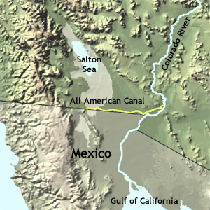
| 10 August 2007, 21:27:45 | 300 × 300 (60639 bytes) | Epolk (talk · contribs) | Desc: A map of the All-American Canal. Source: http://nationalatlas.gov/articles/agriculture/a_ivalley.html License: Public domain (http://www-atlas.usgs.gov/help/faq.html#thirteen) {{PD-USGov-USGS}} [[Maps of California]] [[Maps of canals]] |