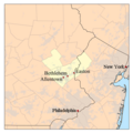
File:Allentown-Bethlehem-Easton Metropolitan Area Map.png
Click on a date/time to view the file as it appeared at that time.
| Date/Time | Thumbnail | Dimensions | User | Comment | |
|---|---|---|---|---|---|
| current | 23:59, 9 February 2010 |  | 500 × 500 (51 KB) | Yassie | added location of Philadelphia and New York City for better understanding of relative location of Lehigh Valley. |
| 20:22, 3 January 2007 |  | 500 × 500 (46 KB) | Kmusser | ||
| 19:48, 3 January 2007 |  | 500 × 500 (45 KB) | Kmusser | ||
| 19:47, 3 January 2007 |  | 300 × 300 (22 KB) | Kmusser | ||
| 19:46, 3 January 2007 |  | 500 × 500 (189 KB) | Kmusser | == Summary == This is a map of the Lehigh Valley Metro area I made using U.S. Census Bureau data. The Metropolitan Statistical Area is shown in yellow. The light gr |
File usage
The following pages on the English Wikipedia use this file (pages on other projects are not listed):
Global file usage
The following other wikis use this file:
- Usage on azb.wikipedia.org
- Usage on de.wikipedia.org
- Usage on es.wikipedia.org
- Usage on fa.wikipedia.org
- Usage on fr.wikipedia.org
- Usage on ja.wikipedia.org
- Usage on tr.wikipedia.org
- Usage on ur.wikipedia.org
- Usage on www.wikidata.org