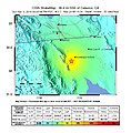
File:April 2010 Baja California Aftershock Intensity USGS.jpg

This file was reviewed on 6 September 2010 by the administrator or trusted user Jappalang (talk), who confirmed the Public Domain status on that date.
|

This file was reviewed on 6 September 2010 by the administrator or trusted user Jappalang (talk), who confirmed the Public Domain status on that date.
|
Click on a date/time to view the file as it appeared at that time.
| Date/Time | Thumbnail | Dimensions | User | Comment | |
|---|---|---|---|---|---|
| current | 21:05, 30 January 2020 |  | 863 × 1,077 (559 KB) | Tinh1000000 | ATLAS 2019-12-23 revision |
| 11:47, 7 April 2010 |  | 612 × 620 (144 KB) | A7x | {{Information |Description={{en|1=Shake map of the magnitude 5.7 aftershock occurring at Baja California, Mexico on April 4, 2010. Epicenter marked at star. This aftershock occured approxiametly an hour after the magnitude 7.2 earthquake at about the same |
The following page uses this file:
The following other wikis use this file: