File:ArmstrongMapHomildon1769.JPG
This work is in the public domain in its country of origin and other countries and areas where the copyright term is the author's life plus 100 years or fewer.
 You must also include a United States public domain tag to indicate why this work is in the public domain in the United States.
This file has been identified as being free of known restrictions under copyright law, including all related and neighboring rights.
Original upload log
The original description page was here. All following user names refer to en.wikipedia.
| Date/Time | Dimensions | User | Comment |
|---|---|---|---|
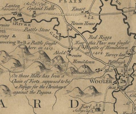
| 2005-06-13 14:03 | 476×399× (48510 bytes) | Nesbit | A detail from Armstrongs map of Northumberland (1769) showing Homildon Hill near Wooler {{PD-old}} |