File:Aroostookrivermap.png
Click on a date/time to view the file as it appeared at that time.
| Date/Time | Thumbnail | Dimensions | User | Comment | |
|---|---|---|---|---|---|
| current | 16:24, 2 February 2007 | 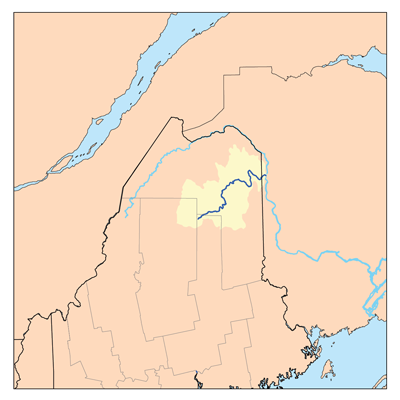 | 400 × 400 (58 KB) | Kmusser | This is a map of the Aroostook river watershed. I, Karl Musser, created it based on USGS and Digital Chart of the World data. {{self|cc-by-sa-2.5}} [[Category:Map |
File usage
The following 3 pages use this file:
Global file usage
The following other wikis use this file:
- Usage on arz.wikipedia.org
- Usage on de.wikipedia.org
- Usage on fr.wikipedia.org
- Usage on it.wikipedia.org
- Usage on pt.wikipedia.org
- Usage on sv.wikipedia.org
- Usage on www.wikidata.org