File:Atoll Mururoa - Map.jpg
Public domain Public domain false false
Original upload log
date/time
username
dimension
file size
edit summary
15:00, 27 January 2006
Pjminton 1240×902
185 KB
Created by Peter Minton (evsrequest@gmail.com) using Landsat S-07-20_2000, Global Mapper and Marplot.)
English Add a one-line explanation of what this file represents
File history
Click on a date/time to view the file as it appeared at that time.
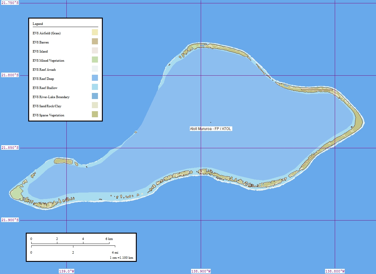
Date/Time Thumbnail Dimensions User Comment current 08:13, 10 July 2008 1,240 × 902 (185 KB) Telim tor == Summary == {{Information |Description = {{de|Karte des Mururoa-Atolls, Tuamotu-Archipel, Französisch-Polynesien}} {{en|Map of the atoll Mururoa, Tuamotu Archipelago, French Polynesia}} {{fr|Carte de l'atoll Mururoa, l'archipel Tuamotu, Polynésie fra
File usage
The following pages on the English Wikipedia use this file (pages on other projects are not listed):
Global file usage
The following other wikis use this file:
Usage on ar.wikipedia.org
Usage on cs.wikipedia.org
Usage on de.wikipedia.org
Usage on frr.wikipedia.org
Usage on fr.wikipedia.org
Usage on he.wikipedia.org
Usage on ka.wikipedia.org
Usage on ms.wikipedia.org
Usage on nl.wikipedia.org
Usage on pl.wikipedia.org
Usage on ro.wikipedia.org
Usage on sk.wikipedia.org
Usage on zh.wikipedia.org
This file contains additional information, probably added from the digital camera or scanner used to create or digitize it.
If the file has been modified from its original state, some details may not fully reflect the modified file.