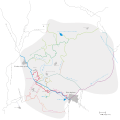
File:BCN 1864 Canal Map And Area.svg
Click on a date/time to view the file as it appeared at that time.
| Date/Time | Thumbnail | Dimensions | User | Comment | |
|---|---|---|---|---|---|
| current | 17:04, 21 November 2007 |  | 2,400 × 2,400 (114 KB) | Oosoom | == Summary == {{Information |Description=Canals in Birmingham, England. Map based on 1864 Birmingham Canal Navigations company map. |Source=self-made from expired copyright map dated 1864 |Date=21 November 2007 |Author |
| 22:09, 2 November 2007 |  | 1,200 × 1,200 (106 KB) | Oosoom | == Summary == {{Information |Description=Canals in Birmingham, England. Map based on 1864 Birmingham Canal Navigations company map. Extent of towns on that date derived from original map. |Source=self-made from expired | |
| 21:54, 2 November 2007 |  | 1,200 × 1,050 (106 KB) | Oosoom | {{Information |Description=Canals in Birmingham, England. Map based on 1864 Birmingham Canal Navigations company map. |Source=self-made from expired copyright map dated 1864 |Date=2 November 2007 |Author= [[User:Oosoom |
File usage
The following pages on the English Wikipedia use this file (pages on other projects are not listed):