Loading
  • 21 Aug, 2019

  • By, Wikipedia

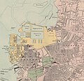
File:Bacon's Map Of Portsmouth (detail).jpg

Hampshire, Comté du -- Côtes Échelle(s) : 6 inches to a mile Couverture : Royaume-Uni – Angleterre – Hampshire Langue : anglais

Éditeur : [s.n.]
Date 19 century
date QS:P571,+1850-00-00T00:00:00Z/7
Dimensions height: 56 cm (22 in); width: 85 cm (33.4 in)
dimensions QS:P2048,56U174728
dimensions QS:P2049,85U174728
Collection
institution QS:P195,Q193563
References
Français : Notice du catalogue : http://catalogue.bnf.fr/ark:/12148/cb40714165q
Source/Photographer
Français : Bibliothèque nationale de France, GEC-199
Bibliothèque nationale de France
Permission
(Reusing this file)
Previous public domain rationale, no longer applicable
Public domain
This image from the Bibliothèque nationale de France (BnF) is a reproduction by scanning of a bidimensional work that is now in the public domain ({{PD-scan}}). For this reason, it is in the public domain.
This image can also be seen on Gallica: Image btv1b530211067.

العربية  Deutsch  English  español  français  galego  italiano  日本語  македонски  Nederlands  português  русский  sicilianu  slovenščina  українська  +/−

Other versions
image extraction process
This file has been extracted from another file
: Bacon's Map of Portsmouth, Portsea, Landport, Southsea and Gosport - btv1b530211067.jpg
original file
Date Source File:Bacon's_Map_of_Portsmouth,_Portsea,_Landport,_Southsea_and_Gosport_-_btv1b530211067.jpg Author George Washington Bacon

Licensing

Previous public domain rationale, no longer applicable
Public domain
This image from the Bibliothèque nationale de France (BnF) is a reproduction by scanning of a bidimensional work that is now in the public domain ({{PD-scan}}). For this reason, it is in the public domain.
This image can also be seen on Gallica: Image btv1b530211067.

العربية  Deutsch  English  español  français  galego  italiano  日本語  македонски  Nederlands  português  русский  sicilianu  slovenščina  українська  +/−

Captions

HM Dockyard Portsmouth c.1880 (detail of Bacon's Map of Portsmouth, Portsea, Landport, Southsea and Gosport).

Items portrayed in this file

depicts

image/jpeg

99ff9ae060116b566c275b0c0e7af35e088bc1a0

2,988,725 byte

2,918 pixel

3,029 pixel

File history

Click on a date/time to view the file as it appeared at that time.

Date/TimeThumbnailDimensionsUserComment
current14:56, 25 August 2023Thumbnail for version as of 14:56, 25 August 20233,029 × 2,918 (2.85 MB)Barabbas1312Uploaded a work by George Washington Bacon from https://commons.wikimedia.org/key/File:Bacon%27s_Map_of_Portsmouth,_Portsea,_Landport,_Southsea_and_Gosport_-_btv1b530211067.jpg with UploadWizard
The following pages on the English Wikipedia use this file (pages on other projects are not listed):

Metadata

This file contains additional information, probably added from the digital camera or scanner used to create or digitize it.

If the file has been modified from its original state, some details may not fully reflect the modified file.

Retrieved from "https://en.wikipedia.org/key/File:Bacon%27s_Map_of_Portsmouth_(detail).jpg"