Click on a date/time to view the file as it appeared at that time.
| Date/Time | Thumbnail | Dimensions | User | Comment |
|---|
| current | 13:20, 30 January 2010 | 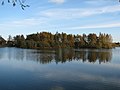 | 640 × 480 (70 KB) | GeographBot | == {{int:filedesc}} == {{Information |description={{en|1=Balderton Lake. Former gravel pit that at one time used to be twice the size. But like most areas half has been infilled for new housing.}} |date=2005-11-12 |source=From [http://www.geograph.org.uk/ |
The following page uses this file:
The following other wikis use this file:
- Usage on ceb.wikipedia.org
- Usage on www.wikidata.org
This file contains additional information, probably added from the digital camera or scanner used to create or digitize it.
If the file has been modified from its original state, some details may not fully reflect the modified file.
