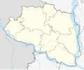
File:Bangladesh Rajshahi Division Location Map.svg
Click on a date/time to view the file as it appeared at that time.
| Date/Time | Thumbnail | Dimensions | User | Comment | |
|---|---|---|---|---|---|
| current | 06:45, 14 November 2023 |  | 1,083 × 885 (441 KB) | C1MM | Added more rivers |
| 05:53, 10 October 2022 |  | 1,083 × 885 (403 KB) | C1MM | Changed bounds and river courses | |
| 19:34, 18 March 2021 |  | 970 × 801 (398 KB) | C1MM | c and bounds | |
| 04:33, 21 December 2020 |  | 889 × 734 (2.27 MB) | C1MM | Fixed points of the location map | |
| 20:03, 6 May 2020 |  | 395 × 372 (117 KB) | C1MM | Uploaded a work by Own work based on User:NNW from File:Bangladesh adm location map.svg with UploadWizard |
File usage
The following 17 pages use this file:
- 2024 Bangladeshi general election
- Bagjana railway station
- Bhabanipur Shaktipith
- Bogra
- Chapai Nawabganj
- Joypurhat
- March 2023 Rajshahi University unrest
- Naogaon
- Natore
- Next Bangladeshi general election
- Pabna
- Rajshahi
- Santahar
- Sirajganj
- User:Zeeshan Y Tariq/sandbox
- Module:Location map/data/Bangladesh Rajshahi division
- Module:Location map/data/Bangladesh Rajshahi division/doc
Global file usage
The following other wikis use this file:
- Usage on bn.wikipedia.org
- রাজশাহী
- মিঠাপুর ইউনিয়ন
- পাকশী ইউনিয়ন
- সান্তাহার ইউনিয়ন
- শাহ বন্দেগী ইউনিয়ন
- সীমাবাড়ী ইউনিয়ন
- বিশালপুর ইউনিয়ন
- গাড়িদহ ইউনিয়ন
- কুসুম্বী ইউনিয়ন
- বিলাশবাড়ী ইউনিয়ন
- বাহাদুরপুর ইউনিয়ন, নিয়ামতপুর
- বদলগাছী ইউনিয়ন
- কোলা ইউনিয়ন, বদলগাছী
- আধাইপুর ইউনিয়ন
- আলীনগর ইউনিয়ন, গোমস্তাপুর
- গোমস্তাপুর ইউনিয়ন
- দামকুড়া ইউনিয়ন
- হুজুরিপাড়া ইউনিয়ন
- মথুরাপুর ইউনিয়ন, চাটমোহর
- উত্তরগ্রাম ইউনিয়ন
- সফাপুর ইউনিয়ন
- রাইগাঁ ইউনিয়ন
- ভীমপুর ইউনিয়ন
- চাঁন্দাশ ইউনিয়ন
- চেরাগপুর ইউনিয়ন
- এনায়েতপুর ইউনিয়ন, মহাদেবপুর
- হাতুড় ইউনিয়ন
- খাজুর ইউনিয়ন
- মহাদেবপুর ইউনিয়ন, মহাদেবপুর
- মনাকষা ইউনিয়ন
- উদয়পুর ইউনিয়ন, কালাই
- মাত্রাই ইউনিয়ন
- জিন্দারপুর ইউনিয়ন
- পুনট ইউনিয়ন
- আহম্মেদাবাদ ইউনিয়ন
- লালোর ইউনিয়ন
- গোহাইল ইউনিয়ন
- সাগরকান্দি ইউনিয়ন
- জাতসাখিনি ইউনিয়ন
- আহম্মদপুর ইউনিয়ন, সুজানগর
- রূপপুর ইউনিয়ন
- মাসুমদিয়া ইউনিয়ন
- পুরান ভারেঙ্গা ইউনিয়ন
- রাণীনগর ইউনিয়ন
- ঢালারচর ইউনিয়ন
- ভাঙ্গাবাড়ী ইউনিয়ন
- মহারাজপুর ইউনিয়ন, চাঁপাইনবাবগঞ্জ সদর
- মথুরাপুর ইউনিয়ন, ধুনট
- মাদলা ইউনিয়ন
- মহিষাবান ইউনিয়ন
View more global usage of this file.