File:Bay Bridge Collapse 2.jpg
USGS
Author
C.E. Meyer
Permission
(Reusing this file)
PD-USGov-Interior-USGS
Other versions
- http://pubs.usgs.gov/dds/dds-29/web_pages/bay_bridge.html
- http://pubs.usgs.gov/dds/dds-29/screens/015sr.jpeg
(Reusing this file)
-
 Uncropped version
 -
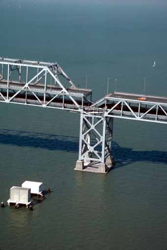
 View westward


Licensing
This image is in the public domain in the United States because it only contains materials that originally came from the United States Geological Survey, an agency of the United States Department of the Interior. For more information, see the official USGS copyright policy.
|
Wikipedia upload log
A Wikipedia description page is/was here. All following user names refer to en.wikipedia.
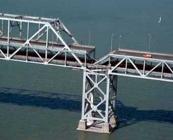
- 2007-09-04 19:13 Paul.h 341×276×8 (12116 bytes) [http://wrgis.wr.usgs.gov/dds/dds-29/ USGS photo] from 1989 Loma Prieta earthquake. '''Caption''': Aerial view of roadbed collapse near the interface of the cantil�T truss sections of the San Francisco-Oakland Bay Bridge. View northwestward. [C.E. Meyer