File:Bevölkerungsprognosen Angermünde.pdf
---
Recent population development (blue lines) and projections (dotted lines) of Angermünde, Uckermark district, Brandenburg state, Germany
Aktuelle Bevölkerungsentwicklung (blaue Linien) und Prognosen (punktierte Linien) für Angermünde , Landkreis Uckermark, Land Brandenburg, Deutschland
Tendencias actuales (lineas azules) y previsiones (lineas de puntos) de la poblacion de Angermünde
File history
Click on a date/time to view the file as it appeared at that time.
| Date/Time | Thumbnail | Dimensions | User | Comment |
|---|
| current | 10:53, 11 August 2024 |  | 1,752 × 1,239 (67 KB) | Hans G. Oberlack | 2023 data added |
| 18:41, 29 July 2023 | 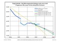 | 1,752 × 1,239 (66 KB) | Hans G. Oberlack | 2022 data added |
| 19:43, 17 August 2022 |  | 1,752 × 1,239 (123 KB) | Hans G. Oberlack | 2021 data added |
| 21:44, 9 October 2021 |  | 1,752 × 1,239 (123 KB) | Hans G. Oberlack | New official forecast and 2020 data added |
| 22:05, 13 August 2020 | No thumbnail | 0 × 0 (123 KB) | Hans G. Oberlack | 2019 data added |
| 17:44, 4 October 2019 | No thumbnail | 0 × 0 (135 KB) | Hans G. Oberlack | 2018 data added |
| 14:26, 27 January 2019 | No thumbnail | 0 × 0 (122 KB) | Hans G. Oberlack | Latest official forecast added |
| 22:02, 4 October 2018 | No thumbnail | 0 × 0 (118 KB) | Hans G. Oberlack | 2017 data added |
| 23:38, 17 March 2018 | No thumbnail | 0 × 0 (117 KB) | Hans G. Oberlack | 2016 data added |
| 18:29, 25 December 2016 | No thumbnail | 0 × 0 (115 KB) | Hans G. Oberlack | New official forecast and 2015 data added |
File usage
The following page uses this file:
Global file usage
The following other wikis use this file:
- Usage on es.wikipedia.org
- Usage on fr.wikipedia.org
- Usage on it.wikipedia.org
- Usage on uk.wikipedia.org
This file contains additional information, probably added from the digital camera or scanner used to create or digitize it.
If the file has been modified from its original state, some details may not fully reflect the modified file.


