Loading
  • 21 Aug, 2019

  • By, Wikipedia

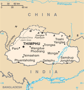
File:Bhutan CIA WFB 2010 Map.png

CIA World Factbook, converted from original GIF format

Author United States Central Intelligence Agency Other versions

Licensing

Public domain
This image is in the public domain because it contains materials that originally came from the United States Central Intelligence Agency's World Factbook.

Bahasa Indonesia  čeština  Deutsch  eesti  English  español  Esperanto  français  galego  hrvatski  italiano  Nederlands  norsk nynorsk  polski  português  sicilianu  slovenščina  suomi  Türkçe  Zazaki  беларуская (тарашкевіца)  македонски  русский  српски / srpski  українська  ქართული  বাংলা  தமிழ்  മലയാളം  한국어  日本語  中文  中文(简体)  中文(繁體)  العربية  +/−

Captions

Add a one-line explanation of what this file represents

Items portrayed in this file

depicts

24 June 2010

image/png

04dfa68d6edb358429fcf35ee51c1345f2f00dea

16,296 byte

350 pixel

326 pixel

File history

Click on a date/time to view the file as it appeared at that time.

Date/TimeThumbnailDimensionsUserComment
current19:40, 6 July 2017Thumbnail for version as of 19:40, 6 July 2017326 × 350 (16 KB)Ras67cropped, opt.
11:56, 12 May 2015Thumbnail for version as of 11:56, 12 May 2015330 × 354 (52 KB)EvoltUpdated to version as of April 24, 2015
12:17, 22 August 2011Thumbnail for version as of 12:17, 22 August 2011330 × 354 (18 KB)Zyxw=={{int:filedesc}}== {{Information | Description = Bhutan map from CIA World Factbook ([http://web.archive.org/web/20100704230847/https://www.cia.gov/library/publications/the-world-factbook/geos/bt.html since June 24, 2010]) | Source = CIA World Factbook,

Global file usage

The following other wikis use this file:

View more global usage of this file.

Metadata