Loading
  • 21 Aug, 2019

  • By, Wikipedia

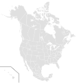
File:BlankMap-North America-Subdivisions.svg

Derivative works of this file:

SVG development
InfoField
 
The SVG code is valid.
 
This vector image was created with Inkscape, or with something else.


All of the subdivisions can be coded by typing their ISO code in all lowercase letters, while all the nations (as a whole) can be coded by typing their ISO code in all uppercase letters. All of the states/provinces have been redrawn to show a more correct border, and are all about the same size in comparison with each other.

Licensing

I, the copyright holder of this work, hereby publish it under the following licenses:
w:en:Creative Commons
attribution share alike
This file is licensed under the Creative Commons Attribution-Share Alike 3.0 Unported license.
You are free:
  • to share – to copy, distribute and transmit the work
  • to remix – to adapt the work
Under the following conditions:
  • attribution – You must give appropriate credit, provide a link to the license, and indicate if changes were made. You may do so in any reasonable manner, but not in any way that suggests the licensor endorses you or your use.
  • share alike – If you remix, transform, or build upon the material, you must distribute your contributions under the same or compatible license as the original.
GNU head Permission is granted to copy, distribute and/or modify this document under the terms of the GNU Free Documentation License, Version 1.2 or any later version published by the Free Software Foundation; with no Invariant Sections, no Front-Cover Texts, and no Back-Cover Texts. A copy of the license is included in the section entitled GNU Free Documentation License.
You may select the license of your choice.
Captions

Add a one-line explanation of what this file represents

Items portrayed in this file

depicts

image/svg+xml

0e6d198eb1e803d3b130821f8cbaca4de7f185ea

1,239,660 byte

1,789 pixel

1,677 pixel

File history

Click on a date/time to view the file as it appeared at that time.

(newest | oldest) View (newer 10 | ) (10 | 20 | 50 | 100 | 250 | 500)
Date/TimeThumbnailDimensionsUserComment
current21:53, 20 September 2023Thumbnail for version as of 21:53, 20 September 20231,677 × 1,789 (1.18 MB)FeRDNYCReverted to version as of 20:20, 20 April 2017 (UTC): Includes Hawaii, unlike previous revert (too far back!) Sets SVG version to 1.1, which is more current and preferable to 1.0.
00:01, 28 November 2022Thumbnail for version as of 00:01, 28 November 20221,677 × 1,789 (1.16 MB)Blackcara100Reverted to version as of 17:55, 20 May 2010 (UTC): Stop reverting, and dont be racist again or reported. Dont change it
21:36, 17 March 2020Thumbnail for version as of 21:36, 17 March 20201,677 × 1,789 (1.18 MB)Yunus Emre505Reverted to version as of 18:15, 20 May 2010 (UTC) This map is black. Pepole don't understand and then says: "What's this?".
20:20, 20 April 2017Thumbnail for version as of 20:20, 20 April 20171,677 × 1,789 (1.18 MB)Tholmeversion 1.1
04:09, 24 February 2017Thumbnail for version as of 04:09, 24 February 20171,677 × 1,789 (1.18 MB)NuclearVacuumReverted to version as of 18:15, 20 May 2010 (UTC)
04:06, 24 February 2017Thumbnail for version as of 04:06, 24 February 20171,677 × 1,789 (892 KB)NuclearVacuumReverted to version as of 15:22, 15 May 2011 (UTC)
19:04, 11 December 2016Thumbnail for version as of 19:04, 11 December 20161,677 × 1,789 (1.18 MB)OrangeOnTheWallReverted to version as of 16:40, 30 November 2016 (UTC)
19:04, 11 December 2016Thumbnail for version as of 19:04, 11 December 20161,677 × 1,789 (892 KB)OrangeOnTheWallReverted to version as of 15:22, 15 May 2011 (UTC)
16:40, 30 November 2016Thumbnail for version as of 16:40, 30 November 20161,677 × 1,789 (1.18 MB)FogheReverted to version as of 18:15, 20 May 2010 (UTC)
15:22, 15 May 2011Thumbnail for version as of 15:22, 15 May 20111,677 × 1,789 (892 KB)NuclearVacuum2011 updated version
(newest | oldest) View (newer 10 | ) (10 | 20 | 50 | 100 | 250 | 500)

The following page uses this file:

Global file usage

Metadata