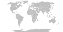
Detailed SVG map with grouping enabled to connect all non-contiguous parts of a country's territory for easy colouring. Smaller countries can also be represented by larger circles to show their data easier. A thorough description of use and other instructions can be found on the instruction page for the non-compact map.
This is a more compact version of BlankMap-World.svg where Antarctica has been removed. Please make any updates primarily to the other map since this one should be kept as identical to the original as possible.
I, the copyright holder of this work, release this work into the public domain. This applies worldwide. In some countries this may not be legally possible; if so: I grant anyone the right to use this work for any purpose, without any conditions, unless such conditions are required by law.
Other versions
Original version including Antarctica and elliptic outline of the oceanDerivative works of this file:
I reverted all changes and made only the following according to www.un.org : North Macedonia, United States of America, Eswatini, United Kingdom of Great Britain and Northern Ireland, Cabo Verde
North Macedonia, Republic of _ Congo, Democratic Republic of the _ Kyrgyz Republic _ Vietnam, Socialist Republic of _ China, People's Republic of _ United States of America _ Eswatini, Kingdom of _ Cabo Verde, Republic of


