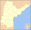
File:Blank Map Andhra Pradesh State And Districts (before 2014).png
Click on a date/time to view the file as it appeared at that time.
| Date/Time | Thumbnail | Dimensions | User | Comment | |
|---|---|---|---|---|---|
| current | 12:33, 7 January 2006 |  | 923 × 881 (136 KB) | Miljoshi | Blank map of w:Andhra Pradesh state, India. |
File usage
The following 41 pages use this file:
- List of districts of Andhra Pradesh
- User:Balajirakonda
- User:C.Kaur
- User:Chaitanyakadiyala
- User:Courtyard208
- User:HarrySupertyphoon
- User:HimSur9
- User:Iune/Old
- User:Iune/UserboxAndhra
- User:Kingshash
- User:Kingshash/Userbox
- User:Krishnagopi06
- User:Krzna
- User:Limelight753
- User:Marquis de Montcalm/Userboxes
- User:Masti 84
- User:Mranilkish
- User:Nagarjuna198
- User:Nishkid64/AP
- User:Nishkid64/About
- User:No2WesternImperialism
- User:Nskjnv
- User:Ramesh Ramaiah/userbox2
- User:Rinku8904
- User:SSG123
- User:Sadhiqali
- User:Sharadbob
- User:Sridhar Babu
- User:Strike Eagle
- User:Svpnikhil
- User:Veera.sj
- User:WP MANIKHANTA
- User:WP MANIKHANTA/sandbox
- User:كيدآس
- User:కిరణ్మయి
- User:దేవుడు
- Wikipedia:WikiProject Dravidian civilizations/User Box
- Wikipedia:WikiProject Dravidian civilizations/User Box/Telugu
- Wikipedia:WikiProject Dravidian civilizations/User Boxes
- Template:User Telugu
- Template:User Telugu Ethnicity
Global file usage
The following other wikis use this file:
- Usage on la.wiktionary.org
- Usage on te.wikipedia.org