21 Aug, 2019
By, Wikipedia
File:Boise Greenbelt Map.jpg
Attribution
Captions
Add a one-line explanation of what this file represents
Click on a date/time to view the file as it appeared at that time.
| Date/Time | Thumbnail | Dimensions | User | Comment | |
|---|---|---|---|---|---|
| current | 00:36, 26 November 2018 | 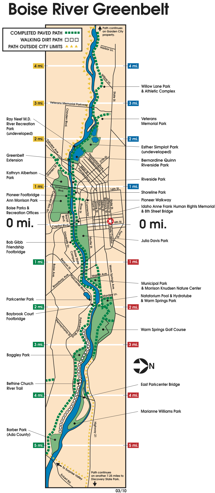 | 912 × 2,091 (999 KB) | Arlo Barnes | Cropped 42 % horizontally, 15 % vertically using CropTool with lossless mode. |
| 19:21, 8 December 2010 |  | 1,584 × 2,448 (1.03 MB) | Boisecynic | {{Information |Description={{en|1=Boise River Greenbelt map}} |Source=http://www.cityofboise.org/Departments/Parks/PDF/ParksandFacilities/greenbelt_map.pdf |Author=City of Boise Idaho Parks and Recreation Department |Date= |Permission= |other_versions= }} |