File:Borneo2 Map English Names.PNG
(English)
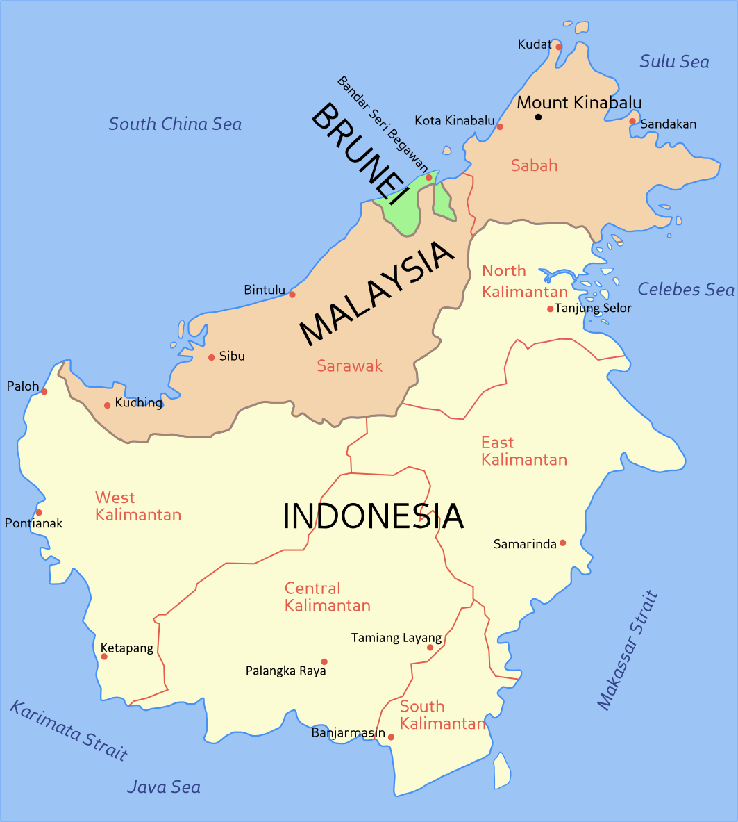
Political map of Borneo, based on information from several maps.
- Light yellow = Indonesia
- Light orange = Malaysia
- Green = Brunei
For a blank political map see Image:Borneo blank map.PNG
(Bahasa Melayu) Peta Borneo, berdasarkan maklumat dari beberapa peta berlainan.
- Kuning cair = Indonesia
- Oren cair = Malaysia
- Hijau = Brunei
Untuk melihat peta Borneo kosong, sila ke Image:Borneo blank map.PNG

|
File:Borneo2 map english names.svg is a vector version of this file. It should be used in place of this PNG file when not inferior.
File:Borneo2 map english names.PNG → File:Borneo2 map english names.svg
For more information, see Help:SVG. |
 |
Licensing

|
Permission is granted to copy, distribute and/or modify this document under the terms of the GNU Free Documentation License, Version 1.2 or any later version published by the Free Software Foundation; with no Invariant Sections, no Front-Cover Texts, and no Back-Cover Texts. A copy of the license is included in the section entitled GNU Free Documentation License. |
| This file is licensed under the Creative Commons Attribution-Share Alike 3.0 Unported license. | ||
| ||
| This licensing tag was added to this file as part of the GFDL licensing update. |

