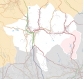
File:Borough Of Rossendale Parishes Map.svg
Geographic limits:
- West: 2.42 °W
- East: 2.14 °W
- North: 53.76 °N
- South: 53.60 °N
- Key
This file was derived from:
- Rossendale UK ward map 2010 (blank).svg: Nilfanion, created using Ordnance Survey data
- Lancashire UK parish map (blank).svg: Nilfanion, created using Ordnance Survey data
- OpenStreetMap: OpenStreetMap contributors
- derivative work: Dr Greg


