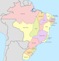
File:Brazil In 1822.svg
Own work based on: Brazil, administrative divisions (states) - en - colored.svg
Author
Milenioscuro
- Mapa geográfico de la mayor parte de la América Meridional que contiene los países por donde debe trazarse la línea divisoria que divida los dominios de España y Portugal
- File:Imperio do Brazil 1822.jpg
- Atlas histórico escolar do Ministério da Educação
- IBGE - Evolução da Divisão Territorial do Brasil 1872-2010
- Origens das fronteiras do Brasil (Terras e Tratados – 1532/1909)
- Tratado firmado en Madrid, a 13 de enero de 1750, para determinar los límites de los Estados pertenecientes a las coronas de España y Portugal, en Asia y América
- Tratado de San Ildefonso entre España y Portugal - 1777
- Primeiro Tratado de Santo Ildefonso
- Tratado de Madrid. 13 de enero de 1750
- Tratado de San Ildefonso. 1º de octubre de 17770
Licensing
I, the copyright holder of this work, hereby publish it under the following license:
This file is licensed under the Creative Commons Attribution-Share Alike 4.0 International license.
- You are free:
- to share – to copy, distribute and transmit the work
- to remix – to adapt the work
- Under the following conditions:
- attribution – You must give appropriate credit, provide a link to the license, and indicate if changes were made. You may do so in any reasonable manner, but not in any way that suggests the licensor endorses you or your use.
- share alike – If you remix, transform, or build upon the material, you must distribute your contributions under the same or compatible license as the original.


