File:Bristol-BUA-2011-border-titles.png
Click on a date/time to view the file as it appeared at that time.
| Date/Time | Thumbnail | Dimensions | User | Comment | |
|---|---|---|---|---|---|
| current | 14:00, 9 October 2017 | 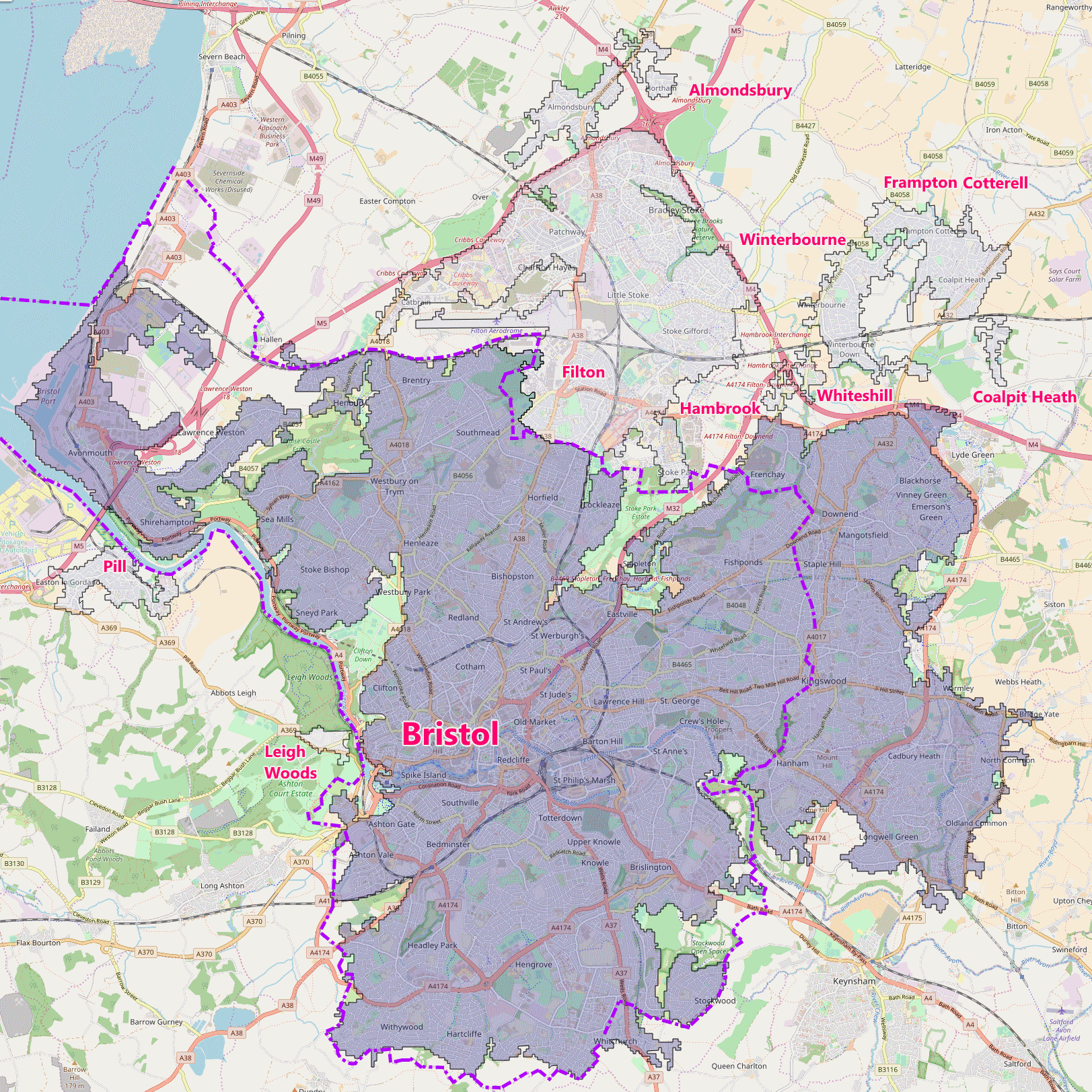 | 1,623 × 1,623 (968 KB) | The Equalizer | Spelling |
| 13:20, 9 October 2017 |  | 1,623 × 1,623 (974 KB) | The Equalizer | {{Information |Description ={{en|1=Bristol built-up area (BUA) in 2011, showing subdivisions, and city (Unitary Authority) border}} |Source =OpenMap and Office for National Statistics (UK). This is a derivative work of an Open Street Map, li... |
File usage
The following page uses this file:
Global file usage
The following other wikis use this file:
- Usage on uk.wikipedia.org